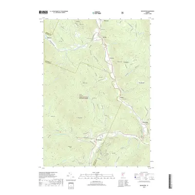
2018 Map of Rochester
USGS Topo · Published 2018About this map
The White River and Tweed River valleys serve as the primary corridors for settlement and transit through this portion of the Green Mountain National Forest. While the high peaks like Wilcox Peak and Rogers Peak dominate the topography, the human history is etched along the riverbanks and mountain roads. In the village of Pittsfield, the Village Cem and a nearby Barn Dance label indicate centers of community life, while the secluded Betsy Bartlett Grave near Stockbridge provides a specific point of interest for local genealogists. Evidence of early industry remains at Swan's Mill on Wing Brook. The map captures a landscape defined by small clusters such as Taleville, Emerson, and Jerusalem, connected by a network of named trails and forest roads like the Martel Meadow Trl and Fusters Trail.
Find a feature on this map
103 named features on this map. Tap any name to fly to it.
Don’t see what you’re looking for? This feature index may not catch every label — zoom into the map to look around manually.
Map Details
Editions of this 2018 Rochester Map
This is the sole edition of this map. No revisions or reprints were ever made.
Other maps of this area

1891 · Rutland
USGS Topo · 1:62,500

1893 · Rutland
USGS Topo · 1:62,500

1911 · Woodstock
USGS Topo · 1:62,500

1913 · Woodstock
USGS Topo · 1:62,500

1915 · Rochester
USGS Topo · 1:62,500

1917 · Rochester
USGS Topo · 1:62,500

1919 · Royalton
USGS Topo · 1:62,500

1924 · Randolph
USGS Topo · 1:48,000

1926 · Randolph
USGS Topo · 1:62,500

1943 · Woodstock
USGS Topo · 1:62,500