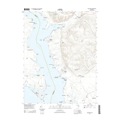
2014 Map of Rock Point
USGS Topo · Published 2014About this map
The Wicomico River dominates this coastal landscape where Charles and Saint Mary's Counties meet along a complex shoreline of points, bars, and coves. The southern end of the map centers on the developed community of Cobb Island, separated from the mainland by the Neale Sound and connected by the Cobb Island Rd. Inland, the terrain rises into the Gravelly Hills, where the historic settlement of Chaptico sits near the head of Chaptico Bay. This area illustrates a classic Chesapeake tidewater pattern where small waterfront hamlets like Bushwood and Saint Catherine are linked by rural routes such as MD-242. Historical depth is evident at the Christ Church Cem near Chaptico, while the transition to modern recreation and residential use is reflected in developments like Mill Point Shores and Longview Beach. Significant maritime features including Bushwood Wharf and White Point Island emphasize the region's enduring connection to the river and sound.
Find a feature on this map
103 named features on this map. Tap any name to fly to it.
Don’t see what you’re looking for? This feature index may not catch every label — zoom into the map to look around manually.
Map Details
Editions of this 2014 Rock Point Map
This is the sole edition of this map. No revisions or reprints were ever made.
Other maps of this area

1892 · Leonardtown
USGS Topo · 1:62,500

1892 · Piney Point
USGS Topo · 1:62,500

1892 · Montross
USGS Topo · 1:62,500

1894 · Wicomico
USGS Topo · 1:62,500

1894 · Piney Point
USGS Topo · 1:62,500

1895 · Wicomico
USGS Topo · 1:62,500

1895 · Leonardtown
USGS Topo · 1:62,500

1895 · Nomini
USGS Topo · 1:125,000

1895 · Piney Point
USGS Topo · 1:62,500

1895 · Montross
USGS Topo · 1:62,500