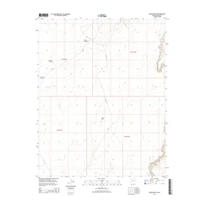
2014 Map of Rock Point SW
USGS Topo · Published 2014About this map
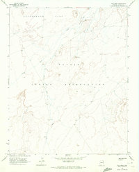
Carson Mesa dominates the southern landscape of this Arizona quadrangle, part of the high-desert plateau within the Shiprock Agency. The drainage system is defined by the ephemeral Trading Post Wash, which cuts through the northwest and central sections, following the contours of the Dibe Chaa Valley. This 2014 survey documents a sparse network of Bureau of Indian Affairs and county roads, such as Bia-8070 and Co Road C560, which provide access through the open terrain. The land is strictly partitioned into township and range blocks, with the intersections of t37n r24e, t37n r25e, t36n r24e, and t36n r25e meeting near the center of the sheet. The absence of concentrated settlements emphasizes the remote, managed nature of this landscape, where geographic features like the mesa and wash remain the primary landmarks for navigation and local orientation.
Find a feature on this map
11 named features on this map. Tap any name to fly to it.
Don’t see what you’re looking for? This feature index may not catch every label — zoom into the map to look around manually.
Map Details
Editions of this 2014 Rock Point SW Map
This is the sole edition of this map. No revisions or reprints were ever made.
Other maps of this area

1892 · Canyon De Chelly
USGS Topo · 1:250,000

1954 · Shiprock
USGS Topo · 1:250,000

1958 · Shiprock
USGS Topo · 1:250,000

1959 · Shiprock
USGS Topo · 1:250,000

1968 · Rock Point SW
USGS Topo · 1:24,000
1968 · Dancing Rocks
USGS Topo · 1:24,000
1968 · White Point
USGS Topo · 1:24,000
1968 · Many Farms NE
USGS Topo · 1:24,000
1968 · Tall Mesa
USGS Topo · 1:24,000

1968 · Windy Valley
USGS Topo · 1:24,000