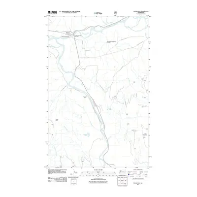
2011 Map of Rockport
USGS Topo · Published 2011About this map
Rockport sits at the vital confluence of the Skagit River and the Sauk River, serving as a central point for river-oriented recreation and transit in Skagit County. The 2011 landscape highlights the Howard Miller Steelhead Recreational Vehicle Park and the Rockport Post Office as focal points of the community, while the Concrete Sauk Valley Road Bridge provides a primary crossing south toward the interior valleys. The terrain transitions from the river lowlands, marked by McLeod Slough and Sutter Creek, to the high elevations of Suiattle Mountain and Rinker Point. The map also documents the water management and rural developments of the area, including the Barnaby Slough Number Two Dam and secluded properties like Hidden Valley Ranch. A network of forest roads and local lanes, such as Illabot Creek Rd and Finney Creek Rd, branch out toward alpine features like Caskey Lake and Hilt Lake.
Find a feature on this map
36 named features on this map. Tap any name to fly to it.
Don’t see what you’re looking for? This feature index may not catch every label — zoom into the map to look around manually.
Map Details
Editions of this 2011 Rockport Map
This is the sole edition of this map. No revisions or reprints were ever made.
Other maps of this area

1899 · Glacier Peak
USGS Topo · 1:125,000

1899 · Stillaguamish
USGS Topo · 1:125,000

1901 · Glacier Peak
USGS Topo · 1:125,000

1901 · Stilaguamish
USGS Topo · 1:125,000

1909 · Mt Baker
USGS Topo · 1:192,000

1915 · Mt. Baker
USGS Topo · 1:250,000

1952 · Lake Shannon
USGS Topo · 1:62,500

1953 · Marblemount
USGS Topo · 1:62,500

1955 · Concrete
USGS Topo · 1:250,000

1958 · Concrete
USGS Topo · 1:250,000