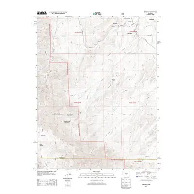
2013 Map of Rockvale
USGS Topo · Published 2013About this map
Rockvale and Williamsburg occupy the northern edge of this Fremont County landscape, situated just west of the larger settlement at Florence. The area's transition from high desert valleys to the eastern foothills of the Rockies is clearly visible as the terrain ascends into the San Isabel National Forest. This 2013 survey details the complex drainage systems that have shaped the local geography, including Coal Creek and the numerous alkaline washes like First Alkali Cr and Second Alkali Cr.
Find a feature on this map
53 named features on this map. Tap any name to fly to it.
Don’t see what you’re looking for? This feature index may not catch every label — zoom into the map to look around manually.
Map Details
Editions of this 2013 Rockvale Map
This is the sole edition of this map. No revisions or reprints were ever made.
Other maps of this area

1889 · Canon City
USGS Topo · 1:125,000

1892 · Canon City
USGS Topo · 1:125,000

1954 · Mount Tyndall
USGS Topo · 1:24,000

1954 · Pueblo
USGS Topo · 1:250,000

1957 · Pueblo
USGS Topo · 1:250,000

1958 · Pueblo
USGS Topo · 1:250,000

1959 · Florence
USGS Topo · 1:24,000
1959 · Canon City
USGS Topo · 1:24,000

1959 · Rockvale
USGS Topo · 1:24,000

1959 · Royal Gorge
USGS Topo · 1:62,500