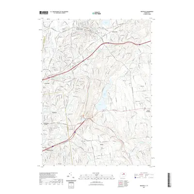
2021 Map of Rockville
USGS Topo · Published 2021About this map
Rockville sits at the heart of this landscape, its urban density marked by legal and civil landmarks like the Tolland County Courthouse and Rockville Superior Court. This part of Connecticut is defined by a complex network of water bodies and reservoirs, with the large expanse of Shenipsit Lake in the north and smaller ponds such as Dobsonville Pond and Paper Mill Pond supporting local industry and drainage into the Hockanum River. The terrain is characterized by several prominent hills including Fox Hill and Birch Mtn, while historic transit corridors like the Hartford Tpke and Boston Tpke connect the surrounding settlements of Vernon, Bolton, and Talcottville. Genealogists will find a high concentration of burial sites, including Saint Bernards Cem and Grove Hill Cem, documenting the long-standing communities of the Capitol Planning Region.
Find a feature on this map
65 named features on this map. Tap any name to fly to it.
Don’t see what you’re looking for? This feature index may not catch every label — zoom into the map to look around manually.
Map Details
Editions of this 2021 Rockville Map
This is the sole edition of this map. No revisions or reprints were ever made.
Other maps of this area

1892 · Hartford
USGS Topo · 1:62,500

1892 · Tolland
USGS Topo · 1:62,500

1892 · Gilead
USGS Topo · 1:62,500

1893 · Middletown
USGS Topo · 1:62,500

1906 · Farmington
USGS Topo · 1:125,000

1921 · Tolland
USGS Topo · 1:62,500

1928 · Glastonbury
USGS Topo · 1:24,000

1928 · Broad Brook
USGS Topo · 1:24,000

1928 · Manchester
USGS Topo · 1:24,000

1944 · Manchester
USGS Topo · 1:31,680