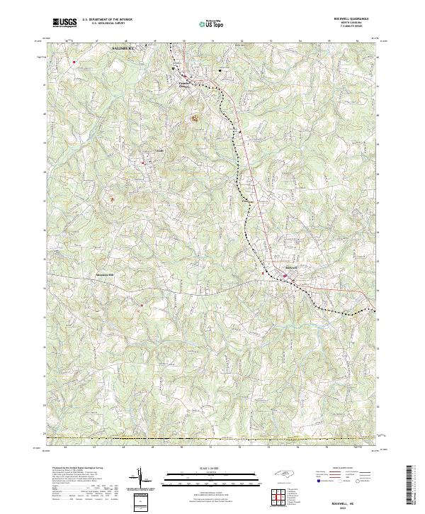
2022 Map of Rockwell
USGS Topo · Published 2022About this map
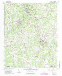
Granite Quarry and the neighboring settlement of Faith serve as the central anchors for this corner of Rowan County, where the landscape is defined by its namesake geology and a complex network of creeks. The topography rises toward Dunn Mtn in the north, overlooking a terrain punctuated by Granite Lake and watercourses like Crane Cr and Second Cr. This area reflects a long-standing pattern of small-scale industrial and agricultural settlement, seen in the presence of Shupings Mill and the cluster of churches and burial grounds that define the local social geography.
Find a feature on this map
218 named features on this map. Tap any name to fly to it.
Don’t see what you’re looking for? This feature index may not catch every label — zoom into the map to look around manually.
Map Details
Editions of this 2022 Rockwell Map
This is the sole edition of this map. No revisions or reprints were ever made.