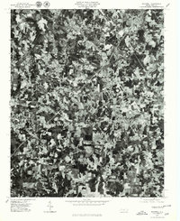
1977 Map of Rockwell
USGS Topo · Published 1979About this map
Rockwell and the surrounding Rowan County landscape are captured in this orthophotomap during the late 1970s. The imagery reveals a mosaic of Piedmont farmstead patterns and small town centers connected by a burgeoning road network. Notable settlements such as Granite Quarry and Faith show distinct residential footprints, while the more dispersed settlement at Crescent reflects the region's agricultural roots. South of these centers, the drainage of Second Creek carves through the terrain, passing near the historic site of Shuping Mill. This aerial perspective provides a unique look at land use and development just before the rapid suburbanization of the late twentieth century, showing the clear boundaries between wooded creek bottoms and cleared fields.
Find a feature on this map
6 named features on this map. Tap any name to fly to it.
Don’t see what you’re looking for? This feature index may not catch every label — zoom into the map to look around manually.
Map Details
Editions of this 1977 Rockwell Map
This is the sole edition of this map. No revisions or reprints were ever made.
Other maps of this area

1893 · Statesville
USGS Topo · 1:125,000

1941 · Charlotte
USGS Topo · 1:125,000

1942 · Charlotte
USGS Topo · 1:125,000

1950 · Concord
USGS Topo · 1:24,000

1953 · Charlotte
USGS Topo · 1:250,000

1954 · Charlotte
USGS Topo · 1:250,000

1957 · Mount Pleasant
USGS Topo · 1:62,500

1960 · Charlotte
USGS Topo · 1:250,000

1962 · Charlotte
USGS Topo · 1:250,000

1962 · Southmont
USGS Topo · 1:24,000