2024 Map of Rockwood
USGS Topo · Published 2024About this map
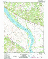
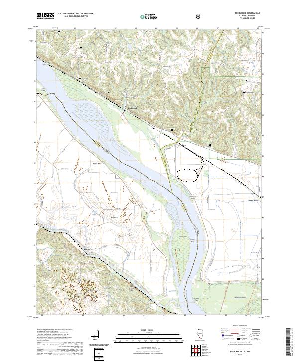
Mississippi River floodplains and the dramatic bluffs of the Shawnee National Forest define this corridor along the Illinois and Missouri border. The landscape is marked by a high density of small family and community burial grounds, including Tindall Cem, Ebenezer Cem, and Hindman Cem, which sit atop the higher ground overlooking the river valley. The river itself reveals complex hydrological features like Potato Bend, Grand Eddy, and Jones Cutoff, alongside substantial river islands such as Crains Island and Rockwood Island. On the Missouri side, the Bois Brule bottomlands stretch toward the base of Saint Cosme Hill, while the Illinois side features the riverfront settlement of Rockwood and the quiet crossroads of Cora. This area, much of which is now protected within the Middle Mississippi River National Wildlife Refuge, remains a critical intersection of river navigation and rugged upland terrain.
Find a feature on this map
76 named features on this map. Tap any name to fly to it.
Don’t see what you’re looking for? This feature index may not catch every label — zoom into the map to look around manually.
Map Details
Editions of this 2024 Rockwood Map
This is the sole edition of this map. No revisions or reprints were ever made.
Historical Maps of Point Rest Through Time
3 maps found