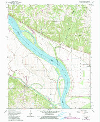
1968 Map of Rockwood
USGS Topo · Published 1990About this map
The Mississippi River carves a deep, winding border between Illinois and Missouri, anchoring a landscape defined by expansive floodplains and riverside bluffs. On the Illinois side, the Shawnee National Forest covers the eastern uplands, while the massive Levee system protects low-lying bottomlands like Bois Brule and Degognia. Small riverside communities like Rockwood and Cora are clustered near the base of the bluffs, while river islands like Rockwood Island and Wilkinson Island shift the navigable channels.
Find a feature on this map
49 named features on this map. Tap any name to fly to it.
Don’t see what you’re looking for? This feature index may not catch every label — zoom into the map to look around manually.
Map Details
Editions of this 1968 Rockwood Map
3 editions found
Other maps of this area

1915 · Chester
USGS Topo · 1:62,500

1916 · Campbell Hill
USGS Topo · 1:62,500

1918 · Altenburg
USGS Topo · 1:62,500

1918 · Campbell Hill
USGS Topo · 1:62,500

1923 · Perryville
USGS Topo · 1:62,500

1924 · Perryville
USGS Topo · 1:62,500

1925 · Altenburg
USGS Topo · 1:62,500

1947 · Chester
USGS Topo · 1:62,500

1947 · Crosstown
USGS Topo · 1:24,000

1947 · Altenburg
USGS Topo · 1:62,500