
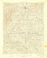
1924 Map of Perryville
USGS Topo · Published 1924About this map
Perryville serves as the regional hub for this mid-1920s Missouri landscape, which is defined by a dense network of country schools and churches that speak to a well-established rural population. The terrain is partitioned by the winding courses of the Whitewater River and Apple Creek, with industrial history evidenced by Bollingers Mill and Conrads Mill situated along the riverbanks. The influence of early religious and educational institutions is clear, from the prominent St Marys Seminary near the county seat to isolated rural sites like York Chapel and Sargents Chapel.
Find a feature on this map
61 named features on this map. Tap any name to fly to it.
Don’t see what you’re looking for? This feature index may not catch every label — zoom into the map to look around manually.
Map Details
Editions of this 1924 Perryville Map
2 editions found
Other maps of this area

1907 · Weingarten
USGS Topo · 1:62,500

1909 · Weingarten
USGS Topo · 1:62,500

1910 · Higdon
USGS Topo · 1:62,500

1915 · Chester
USGS Topo · 1:62,500

1916 · Campbell Hill
USGS Topo · 1:62,500

1918 · Altenburg
USGS Topo · 1:62,500

1918 · Campbell Hill
USGS Topo · 1:62,500

1922 · Cape Girardeau
USGS Topo · 1:62,500

1923 · Perryville
USGS Topo · 1:62,500

1924 · Cape Girardeau
USGS Topo · 1:62,500