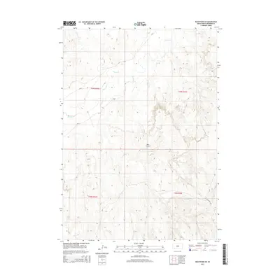
2015 Map of Rockyford SW
USGS Topo · Published 2015About this map
The White River winds through the northwestern corner of this landscape, carving through a region defined by its distinct drainage patterns and dramatic elevation changes. The terrain is dominated by the deeply incised Wolf Canyon in the central-eastern portion, where the topography rises sharply from the river valley. This 2015 survey illustrates the modern road network within the Wounded Knee District, characterized by Bureau of Indian Affairs routes such as Bia-16, Bia-8, and Bia-24. These roads provide essential connectivity across the high plains and breaks of Oglala Lakota County. In the south, Grass Creek Rd serves as a primary local connector, while the seasonal flow of W Horse Cr feeds into the larger river system to the north. The map reflects a rural, open landscape structured by the Public Land Survey System, showing the townships and ranges of the Pine Ridge Reservation.
Find a feature on this map
11 named features on this map. Tap any name to fly to it.
Don’t see what you’re looking for? This feature index may not catch every label — zoom into the map to look around manually.
Map Details
Editions of this 2015 Rockyford SW Map
This is the sole edition of this map. No revisions or reprints were ever made.
Other maps of this area

1951 · Rockyford SW
USGS Topo · 1:24,000

1951 · Rockyford NW
USGS Topo · 1:24,000

1951 · Willow Creek NE
USGS Topo · 1:24,000

1951 · Rockyford
USGS Topo · 1:24,000

1951 · Rockyford SE
USGS Topo · 1:24,000

1955 · Hot Springs
USGS Topo · 1:250,000

1967 · Pine Ridge NE
USGS Topo · 1:24,000

1967 · Oglala
USGS Topo · 1:24,000

1967 · Slim Butte NE
USGS Topo · 1:24,000

1967 · Willow Creek
USGS Topo · 1:24,000