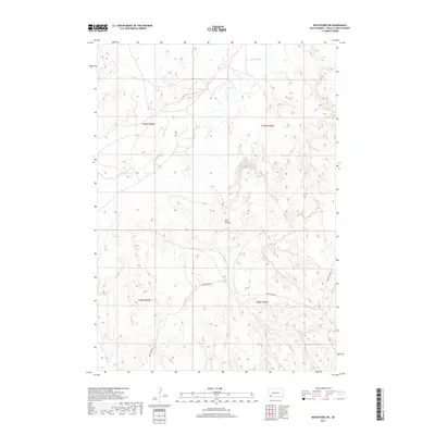
2017 Map of Rockyford SW
USGS Topo · Published 2017About this map
The White River winds across the northern landscape of the Wounded Knee District, carving a path through the high plains of South Dakota. This 2017 study illustrates a sparsely settled area defined by the natural contours of the land, where W Horse Cr feeds into the larger drainage system. The terrain is notably marked by Wolf Canyon, which provides significant relief in the southern portion of the quadrangle. Transportation is limited to a few arterial routes like Grass Creek Rd, which cuts across the lower sections of the map. The layout reflects a contemporary look at the Oglala Lakota County interior, showing how modern land divisions under the Public Land Survey System—including t39n r46w and t38n r45w—interact with the traditional topography of the plains.
Find a feature on this map
8 named features on this map. Tap any name to fly to it.
Don’t see what you’re looking for? This feature index may not catch every label — zoom into the map to look around manually.
Map Details
Editions of this 2017 Rockyford SW Map
This is the sole edition of this map. No revisions or reprints were ever made.
Other maps of this area

1951 · Rockyford SW
USGS Topo · 1:24,000

1951 · Rockyford NW
USGS Topo · 1:24,000

1951 · Willow Creek NE
USGS Topo · 1:24,000

1951 · Rockyford
USGS Topo · 1:24,000

1951 · Rockyford SE
USGS Topo · 1:24,000

1955 · Hot Springs
USGS Topo · 1:250,000

1967 · Pine Ridge NE
USGS Topo · 1:24,000

1967 · Oglala
USGS Topo · 1:24,000

1967 · Slim Butte NE
USGS Topo · 1:24,000

1967 · Willow Creek
USGS Topo · 1:24,000