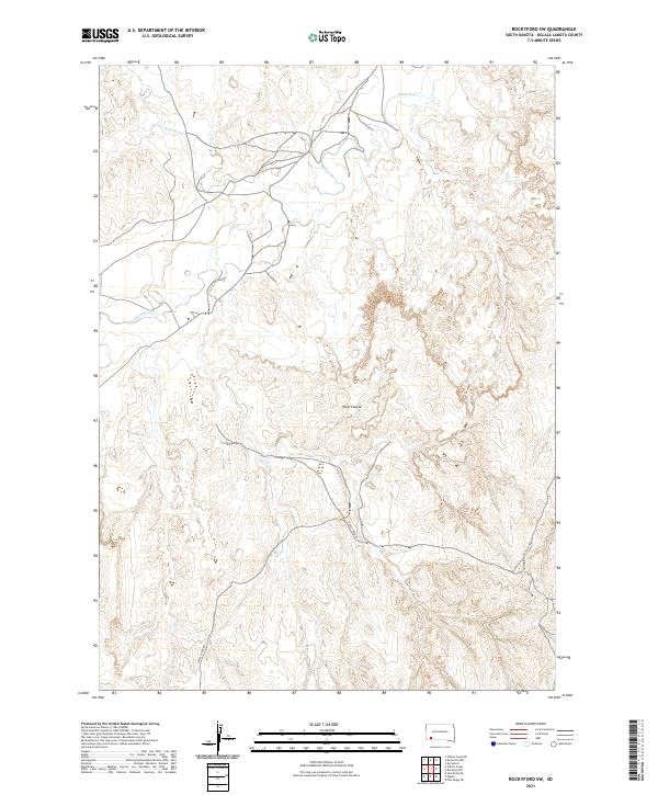
2021 Map of Rockyford SW
USGS Topo · Published 2021About this map
The White River carves a winding path across this portion of Oglala Lakota County, defining the drainage patterns for the surrounding prairie. Much of the terrain is shaped by the presence of Wolf Canyon, where the elevation changes reveal the complex erosional history of the South Dakota landscape. Transportation in this section of the Pine Ridge Reservation is sparse, primarily centered on Grass Creek Rd and a network of unimproved trails that connect the high ridges to the river valley. Water sources like W Horse Cr provide the few breaks in the topography, which is largely partitioned by the Public Land Survey System boundaries of t39n r46w and t39n r45w. The map illustrates a landscape where natural watercourses and canyon systems remain the primary geographic anchors in an area defined by its open space and limited infrastructure.
Find a feature on this map
8 named features on this map. Tap any name to fly to it.
Don’t see what you’re looking for? This feature index may not catch every label — zoom into the map to look around manually.
Map Details
Editions of this 2021 Rockyford SW Map
This is the sole edition of this map. No revisions or reprints were ever made.
Other maps of this area

1951 · Rockyford SW
USGS Topo · 1:24,000

1951 · Rockyford NW
USGS Topo · 1:24,000

1951 · Willow Creek NE
USGS Topo · 1:24,000

1951 · Rockyford
USGS Topo · 1:24,000

1951 · Rockyford SE
USGS Topo · 1:24,000

1955 · Hot Springs
USGS Topo · 1:250,000

1967 · Pine Ridge NE
USGS Topo · 1:24,000

1967 · Oglala
USGS Topo · 1:24,000

1967 · Slim Butte NE
USGS Topo · 1:24,000

1967 · Willow Creek
USGS Topo · 1:24,000