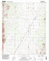
1996 Map of Rodeo
USGS Topo · Published 2003About this map
The borderlands of the American Southwest are defined here by the meeting of the Arizona New Mexico state line and the Cochise Co Hidalgo Co boundary. The settlement of Rodeo serves as a central hub in this high-desert landscape, situated along an Old Railroad Grade that speaks to the region's historic transportation corridors. To the west, the terrain rises sharply into the Coronado National Forest and the protected peaks of the Chiricahua National Wilderness, where Horseshoe Canyon cuts through the steep slopes.
Find a feature on this map
15 named features on this map. Tap any name to fly to it.
Don’t see what you’re looking for? This feature index may not catch every label — zoom into the map to look around manually.
Map Details
Editions of this 1996 Rodeo Map
This is the sole edition of this map. No revisions or reprints were ever made.
Other maps of this area

1917 · Chiricahua
USGS Topo · 1:125,000

1918 · Animas Peak
USGS Topo · 1:62,500

1918 · Pratt
USGS Topo · 1:62,500

1919 · Pratt
USGS Topo · 1:62,500

1919 · Chiricahua
USGS Topo · 1:125,000

1920 · Animas Peak
USGS Topo · 1:62,500

1926 · Rodeo
USGS Topo · 1:62,500

1940 · Apache
USGS Topo · 1:62,500

1955 · Douglas
USGS Topo · 1:250,000

1958 · Apache
USGS Topo · 1:62,500