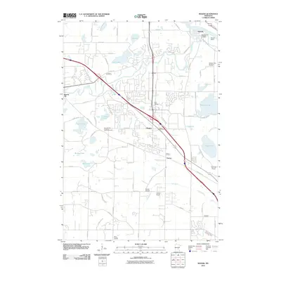
2010 Map of Rogers
USGS Topo · Published 2010About this map
The Crow River winds through this Hennepin County landscape, meeting the Mississippi River near Dayton at the map's northern edge. The area is defined by its numerous small lakes and wetlands, including Rice Lake, Sylvan Lake, and French Lake, which alternate with modern developments and several expansive golf courses like Fox Hollow Golf Course. The growing infrastructure around Rogers is evident, centered on the Rogers Post Office and a dense network of roads such as Territorial Rd and Brockton Ln N.
Find a feature on this map
83 named features on this map. Tap any name to fly to it.
Don’t see what you’re looking for? This feature index may not catch every label — zoom into the map to look around manually.
Map Details
Editions of this 2010 Rogers Map
This is the sole edition of this map. No revisions or reprints were ever made.
Other maps of this area

1902 · Anoka
USGS Topo · 1:62,500

1909 · Rockford
USGS Topo · 1:62,500

1916 · St. Francis
USGS Topo · 1:62,500

1919 · St. Francis
USGS Topo · 1:62,500

1953 · Stillwater
USGS Topo · 1:250,000

1955 · Osseo
USGS Topo · 1:24,000

1955 · Anoka
USGS Topo · 1:24,000

1955 · Anoka
USGS Topo · 1:62,500

1955 · Stillwater
USGS Topo · 1:250,000

1958 · Stillwater
USGS Topo · 1:250,000