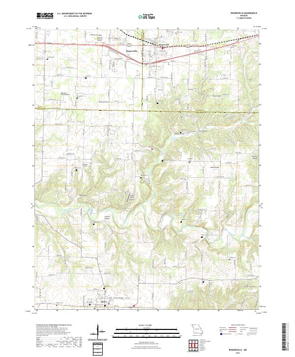
2021 Map of Rogersville
USGS Topo · Published 2021About this map
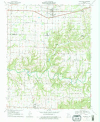
Rogersville and Sparta anchor this Ozark landscape, where the BNSF Railway parallels the historic corridor of Highway 60. The terrain is defined by a series of deep hollows and ridges, including Mooney Hollow, Peck Ridge, and Big Hollow, which channel drainage toward Finley Creek and Pedelo Cr. This topography has long influenced local settlement patterns, leaving a legacy of small family and community burial grounds scattered across the hills, such as Holland Cem, Farmer Cem, and Monger Cem.
Find a feature on this map
147 named features on this map. Tap any name to fly to it.
Don’t see what you’re looking for? This feature index may not catch every label — zoom into the map to look around manually.
Map Details
Editions of this 2021 Rogersville Map
This is the sole edition of this map. No revisions or reprints were ever made.
Historical Maps of Velsor Through Time
3 maps found