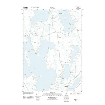
2011 Map of Rome
USGS Topo · Published 2011About this map
Great Pond and East Pond anchor this detailed study of the Maine lakes region, where the town of Rome sits among a landscape defined by glacial hills and interconnected waterways. The 2011 survey reveals a complex network of seasonal and year-round roads, including Horse Point Rd and Taylor Woods Rd, serving numerous lakeside points and islands. Historically significant sites such as the Whitehouse Cemetery and the industrial marker of Ellis Pond Dam provide anchor points for local history research. The presence of North Belgrade Station and North Belgrade along the southeastern shore of Great Pond indicates the area's long-standing role as a recreational and residential hub. Notable terrain features like Foss Hill, Mosher Hill, and Bickford Hill rise between the basins of North Pond and Messalonskee Lake, illustrating the varied topography that has shaped the settlement patterns of Kennebec and Somerset counties.
Find a feature on this map
137 named features on this map. Tap any name to fly to it.
Don’t see what you’re looking for? This feature index may not catch every label — zoom into the map to look around manually.
Map Details
Editions of this 2011 Rome Map
This is the sole edition of this map. No revisions or reprints were ever made.
Other maps of this area

1892 · Waterville
USGS Topo · 1:62,500

1892 · Augusta
USGS Topo · 1:62,500

1893 · Vassalboro
USGS Topo · 1:62,500

1894 · Norridgewock
USGS Topo · 1:62,500

1898 · Norridgewock
USGS Topo · 1:62,500

1898 · Vassalboro
USGS Topo · 1:62,500

1941 · Vassalboro
USGS Topo · 1:62,500

1941 · Augusta
USGS Topo · 1:62,500

1943 · Augusta
USGS Topo · 1:62,500

1943 · Vassalboro
USGS Topo · 1:62,500