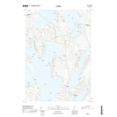
2018 Map of Rome
USGS Topo · Published 2018About this map
Rome is positioned at the heart of this lake-heavy terrain, where a complex network of points and peninsulas reaches into Great Pond and North Pond. The 2018 survey reveals a landscape defined by its glacial heritage, with prominent elevations such as Bickford Hill, Varney Hill, and Mutton Hill rising above the waterfront. Local family history is preserved through numerous small burial grounds scattered across the hillsides, including Tuttle Cem, Chute Cem, and the Bickford Ellis Cem near McGrath Pond. Along the eastern edge, the settlements of North Belgrade and North Belgrade Station sit near the shores of Ellis Pond and Messalonskee Lake. The intricate shoreline, featuring landforms like Jamaica Point, Snake Point, and Horse Point, suggests a long-standing pattern of seasonal and permanent settlement oriented toward these expansive Maine waters.
Find a feature on this map
140 named features on this map. Tap any name to fly to it.
Don’t see what you’re looking for? This feature index may not catch every label — zoom into the map to look around manually.
Map Details
Editions of this 2018 Rome Map
This is the sole edition of this map. No revisions or reprints were ever made.
Other maps of this area

1892 · Waterville
USGS Topo · 1:62,500

1892 · Augusta
USGS Topo · 1:62,500

1893 · Vassalboro
USGS Topo · 1:62,500

1894 · Norridgewock
USGS Topo · 1:62,500

1898 · Norridgewock
USGS Topo · 1:62,500

1898 · Vassalboro
USGS Topo · 1:62,500

1941 · Vassalboro
USGS Topo · 1:62,500

1941 · Augusta
USGS Topo · 1:62,500

1943 · Augusta
USGS Topo · 1:62,500

1943 · Vassalboro
USGS Topo · 1:62,500