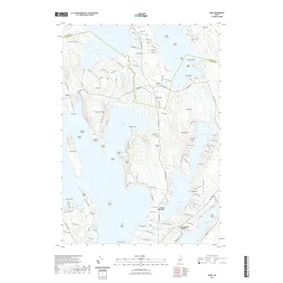
2021 Map of Rome
USGS Topo · Published 2021About this map
Great Pond and its intricate shoreline dominate this Maine landscape, where the town of Rome and village of North Belgrade are defined by their proximity to these massive glacial water bodies. The geography is a complex network of peninsulas and islands, including Snake Point, Horse Point, and Oak Island, which separate the various bays and coves. Local family history is preserved in small burial grounds scattered across the terrain, such as the Mosher Hill-Chute Cem and Tuttle Cem. At the southern edge, North Belgrade Station indicates the historical transport links that once connected this lake-centered economy to the wider region. The elevations around Foss Hill and Varney Hill offer a glimpse into the topographical relief that frames North Pond and Ellis Pond, illustrating how the early road networks, like Rome RD and Smithfield RD, were forced to navigate the irregular shoreline and steep ridges.
Find a feature on this map
118 named features on this map. Tap any name to fly to it.
Don’t see what you’re looking for? This feature index may not catch every label — zoom into the map to look around manually.
Map Details
Editions of this 2021 Rome Map
This is the sole edition of this map. No revisions or reprints were ever made.
Other maps of this area

1892 · Waterville
USGS Topo · 1:62,500

1892 · Augusta
USGS Topo · 1:62,500

1893 · Vassalboro
USGS Topo · 1:62,500

1894 · Norridgewock
USGS Topo · 1:62,500

1898 · Norridgewock
USGS Topo · 1:62,500

1898 · Vassalboro
USGS Topo · 1:62,500

1941 · Vassalboro
USGS Topo · 1:62,500

1941 · Augusta
USGS Topo · 1:62,500

1943 · Augusta
USGS Topo · 1:62,500

1943 · Vassalboro
USGS Topo · 1:62,500