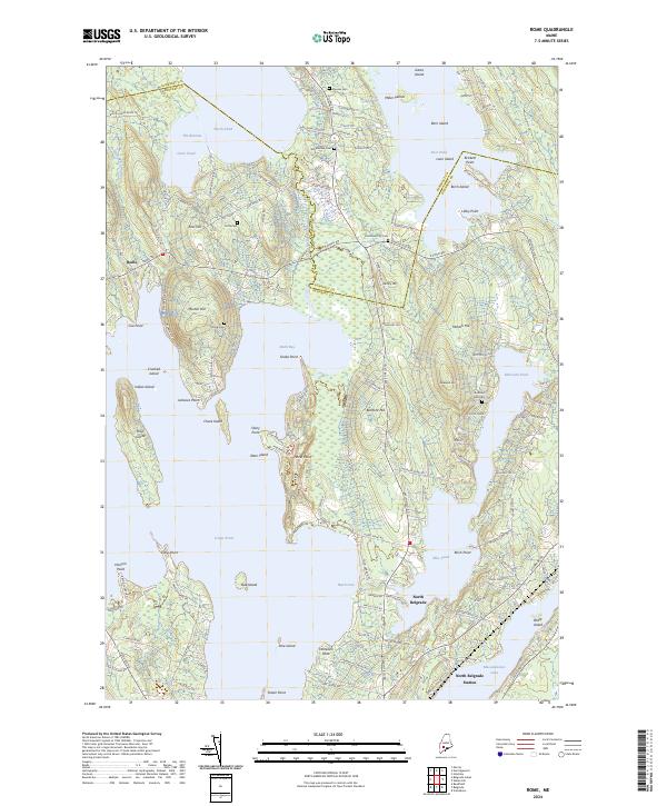
2024 Map of Rome
USGS Topo · Published 2024About this map
Rome and the surrounding Belgrade Lakes region are defined by an intricate network of waterways and peninsula settlements. This landscape is shaped by significant water bodies including Great Pond, North Pond, and East Pond, which are punctuated by numerous named islands such as Pine Island and Loon Island. The map reveals a high density of local heritage sites, particularly small family and community burying grounds like Tuttle Cem, Chute Cem, and the Whitehouse Cem. These sites, often located near historic farmsteads or along older road alignments like Rome Rd and Smithfield Rd, provide a window into the generations of families that settled this area between the Kennebec and Somerset county lines.
Find a feature on this map
137 named features on this map. Tap any name to fly to it.
Don’t see what you’re looking for? This feature index may not catch every label — zoom into the map to look around manually.
Map Details
Editions of this 2024 Rome Map
This is the sole edition of this map. No revisions or reprints were ever made.
Other maps of this area

1892 · Waterville
USGS Topo · 1:62,500

1892 · Augusta
USGS Topo · 1:62,500

1893 · Vassalboro
USGS Topo · 1:62,500

1894 · Norridgewock
USGS Topo · 1:62,500

1898 · Norridgewock
USGS Topo · 1:62,500

1898 · Vassalboro
USGS Topo · 1:62,500

1941 · Vassalboro
USGS Topo · 1:62,500

1941 · Augusta
USGS Topo · 1:62,500

1943 · Augusta
USGS Topo · 1:62,500

1943 · Vassalboro
USGS Topo · 1:62,500