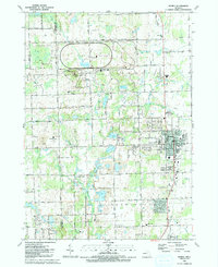
1991 Map of Romeo
USGS Topo · Published 1991About this map
Romeo stands as the primary residential hub on this 1991 landscape, where the street grid of the village meets the sprawling suburban and rural transition of northern Macomb and Oakland counties. The village center is densely marked with civic and spiritual anchors like St Pauls Ch, Jr High Sch, and the historical Romeo Cem. Surrounding the town, the terrain is defined by a dense concentration of glacial kettles and lakes, including East Mill Lake, Cusick Lake, and Thornington Lake. A significant industrial and research footprint is visible at the large Proving Ground facility to the north, which dominates the topography near Fisher Lake and Twombly Mtn. Moving south, the landscape shifts toward recreation and conservation within Stony Creek Metropolitan Park, highlighting the 1990s-era balance between utility, industry, and the preservation of the Stony Creek watershed.
Find a feature on this map
77 named features on this map. Tap any name to fly to it.
Don’t see what you’re looking for? This feature index may not catch every label — zoom into the map to look around manually.
Map Details
Editions of this 1991 Romeo Map
This is the sole edition of this map. No revisions or reprints were ever made.
Other maps of this area

1908 · Rochester
USGS Topo · 1:62,500

1912 · Mt Clemens
USGS Topo · 1:62,500

1914 · Armada
USGS Topo · 1:62,500

1928 · Armada
USGS Topo · 1:62,500

1929 · Mt Clemens
USGS Topo · 1:62,500

1936 · Rochester
USGS Topo · 1:31,680

1936 · Washington
USGS Topo · 1:31,680

1936 · Waldenburg
USGS Topo · 1:31,680

1943 · Lake Orion
USGS Topo · 1:24,000

1943 · Romeo
USGS Topo · 1:24,000
Featured Places
- Washington Charter Township, MI
- Oakland Charter Township, MI
- Addison Township, MI
- Romeo, MI
- Clifton Mill, Washington Charter Township