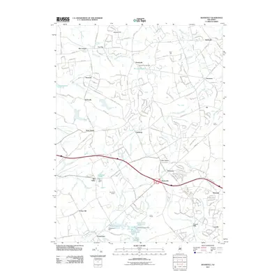
2011 Map of Roosevelt
USGS Topo · Published 2011About this map
Roosevelt stands as a central point of interest in this 2011 survey, surrounded by a dense network of residential streets such as N Rochdale Ave and Witches Hollow Rd. The landscape is defined by the headwaters of several significant drainage systems, including Assunpink Creek and the Toms River. This era shows a community deeply integrated with its water resources, evidenced by the numerous dams like Perrineville Lake Dam and Lahaway Plantation Dam.
Find a feature on this map
223 named features on this map. Tap any name to fly to it.
Don’t see what you’re looking for? This feature index may not catch every label — zoom into the map to look around manually.
Map Details
Editions of this 2011 Roosevelt Map
This is the sole edition of this map. No revisions or reprints were ever made.
Other maps of this area

1888 · Bordentown
USGS Topo · 1:62,500

1888 · New Brunswick
USGS Topo · 1:62,500

1888 · Princeton
USGS Topo · 1:62,500

1888 · Cassville
USGS Topo · 1:62,500

1893 · Bordentown
USGS Topo · 1:62,500

1893 · New Brunswick
USGS Topo · 1:62,500

1894 · Princeton
USGS Topo · 1:62,500

1894 · Cassville
USGS Topo · 1:62,500

1900 · Cassville
USGS Topo · 1:62,500

1901 · New Brunswick
USGS Topo · 1:62,500
Featured Places
- Jackson Township, NJ
- Manalapan Township, NJ
- Freehold Township, NJ
- East Windsor Township, NJ
- Millstone Township, NJ