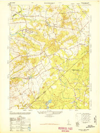
1948 Map of Roosevelt
USGS Topo · Published 1948About this map
Roosevelt stands as a notable center of planned development in this 1948 survey, formerly known as Jersey Homesteads, an agricultural and industrial colony established during the Depression. The surrounding landscape of central New Jersey is defined by a intricate network of watercourses and agrarian infrastructure, including Assunpink Creek and the headwaters of the Millstone River. To the south, the terrain transitions into a region marked by numerous Cranberry bogs and small crossroads settlements such as Clarksburg and Red Valley.
Find a feature on this map
37 named features on this map. Tap any name to fly to it.
Don’t see what you’re looking for? This feature index may not catch every label — zoom into the map to look around manually.
Map Details
Editions of this 1948 Roosevelt Map
This is the sole edition of this map. No revisions or reprints were ever made.
Other maps of this area

1888 · Bordentown
USGS Topo · 1:62,500

1888 · New Brunswick
USGS Topo · 1:62,500

1888 · Princeton
USGS Topo · 1:62,500

1888 · Cassville
USGS Topo · 1:62,500

1893 · Bordentown
USGS Topo · 1:62,500

1893 · New Brunswick
USGS Topo · 1:62,500

1894 · Princeton
USGS Topo · 1:62,500

1894 · Cassville
USGS Topo · 1:62,500

1900 · Cassville
USGS Topo · 1:62,500

1901 · New Brunswick
USGS Topo · 1:62,500
Featured Places
- Jackson Township, NJ
- Manalapan Township, NJ
- Freehold Township, NJ
- East Windsor Township, NJ
- Millstone Township, NJ