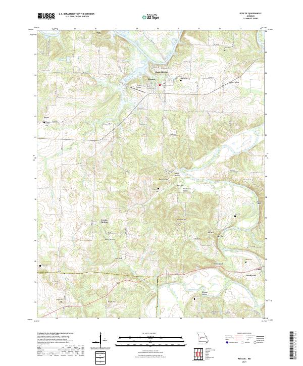
2021 Map of Roscoe
USGS Topo · Published 2021About this map
Roscoe and Osage Heights sit near the confluence of the Osage River and Sac River in this survey of St. Clair and Cedar counties. The landscape is defined by its watercourses, where the Osage winds past Reader Hill and Sandy Hollow while the Sac River cuts through dramatic bluffs like Lutz Bluff, Keel Bluff, and Buzzard Bluff. The area's rural character is evidenced by the distribution of numerous family and community burial grounds, including Moore Cem, Culbertson Cem, and the uniquely named Love Mound Cem.
Find a feature on this map
81 named features on this map. Tap any name to fly to it.
Don’t see what you’re looking for? This feature index may not catch every label — zoom into the map to look around manually.
Map Details
Editions of this 2021 Roscoe Map
This is the sole edition of this map. No revisions or reprints were ever made.
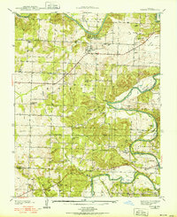
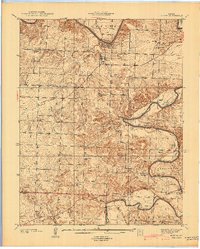
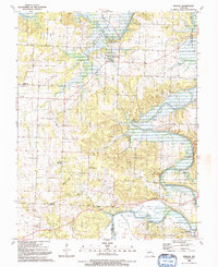
Historical Maps of Oyer Through Time
4 maps found