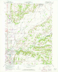
1962 Map of Rosedale
USGS Topo · Published 1973About this map
Otter Creek meanders through the central Indiana landscape, defining a region where small industrial settlements and rail junctions emerged during the mid-20th century. The intricate rail network, featuring lines like the Penn Central and Louisville and Nashville, illustrates the importance of this corridor for coal and logistics, notably serving the Strip Mine near Ehrmandale. The map reveals a dense layer of genealogical data, from the Rosefawn Memorial Park to family-named plots like Kennedy Cem and Rukes Cem.
Find a feature on this map
57 named features on this map. Tap any name to fly to it.
Don’t see what you’re looking for? This feature index may not catch every label — zoom into the map to look around manually.
Map Details
Editions of this 1962 Rosedale Map
Other maps of this area

1908 · Clay City
USGS Topo · 1:48,000

1910 · Clay City
USGS Topo · 1:62,500

1941 · Seelyville
USGS Topo · 1:24,000

1941 · Terre Haute
USGS Topo · 1:24,000

1948 · Terre Haute
USGS Topo · 1:24,000

1950 · Rosedale
USGS Topo · 1:24,000

1950 · Brazil West
USGS Topo · 1:24,000

1950 · New Goshen
USGS Topo · 1:24,000

1951 · Clinton
USGS Topo · 1:24,000

1951 · Mecca
USGS Topo · 1:24,000