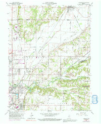
1962 Map of Rosedale
USGS Topo · Published 1992About this map
Otter Creek meanders across this landscape, defining the rural and industrial character of the border between Parke Co and Vigo Co during the mid-20th century. The settlement of Rosedale anchors the north, while the expanding footprint of North Terre Haute and Seelyville to the south reveals a region in transition. The map details a complex transportation network where the Penn Central, Baltimore And Ohio, and Louisville And Nashville railroads intersect, facilitating the movement of coal from local Strip Mine operations.
Find a feature on this map
79 named features on this map. Tap any name to fly to it.
Don’t see what you’re looking for? This feature index may not catch every label — zoom into the map to look around manually.
Map Details
Editions of this 1962 Rosedale Map
Other maps of this area

1908 · Clay City
USGS Topo · 1:48,000

1910 · Clay City
USGS Topo · 1:62,500

1941 · Seelyville
USGS Topo · 1:24,000

1941 · Terre Haute
USGS Topo · 1:24,000

1948 · Terre Haute
USGS Topo · 1:24,000

1950 · Rosedale
USGS Topo · 1:24,000

1950 · Brazil West
USGS Topo · 1:24,000

1950 · New Goshen
USGS Topo · 1:24,000

1951 · Clinton
USGS Topo · 1:24,000

1951 · Mecca
USGS Topo · 1:24,000