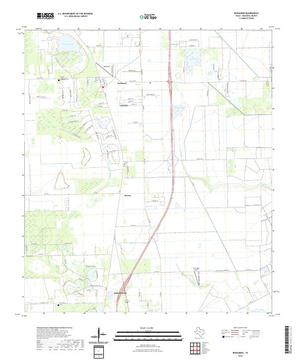
2022 Map of Rosharon
USGS Topo · Published 2022About this map
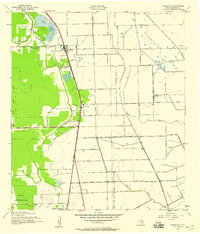
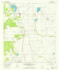
Low-lying prairie and coastal wetlands define this region of Brazoria County, where the sprawling drainage systems of Austin Bayou and Flores Bayou wind through the landscape. The settlement of Rosharon serves as a central hub, situated near the Rosharon Lateral and surrounded by a network of rural routes like W FM 1462 and Co RD 48. For those researching family history, the map identifies the Pilgrims Knights-and- Daughters Cem in the northwest and Providence Cem to the south, providing critical coordinates for genealogical study.
Find a feature on this map
84 named features on this map. Tap any name to fly to it.
Don’t see what you’re looking for? This feature index may not catch every label — zoom into the map to look around manually.
Map Details
Editions of this 2022 Rosharon Map
This is the sole edition of this map. No revisions or reprints were ever made.
Historical Maps of Alvin Through Time
3 maps found