Old Maps of Brazoria County, Texas
Explore 117 old maps of Brazoria County, spanning from 1916 to today. These high-resolution historic maps reveal how streets, neighborhoods, landmarks, and natural features evolved over time — perfect for genealogy, metal detecting, research, and local history exploration.
What you can do with these maps:
- See how Brazoria County changed over time: Compare historical maps to modern-day views to trace roads, homesites, rail lines & more.
- View detailed metadata: Each map includes creators, publishers, year, scale, and archive source.
- Overlay maps with satellite & LiDAR: Visualize the past alongside modern tools to explore terrain & human change.
- Trusted historical sources: Maps sourced from the USGS, Library of Congress, and other archives.
- Access maps your way: View online, download high-res files, or order prints for personal or research use.
Start exploring old maps of Brazoria County to uncover forgotten places, hidden landmarks, and the deep history beneath your feet.
Brazoria County, TX maps
(117)- 1916 Map of Genoa
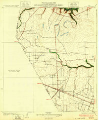
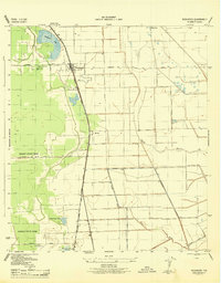
 1916 Genoa1916 Print · USGSSoutheast Texas coastal prairie development is captured here during the First World War era, showing the intersection of early electric rail and county life. Trace the old routes of the Galveston Houston Electric or locate the Friendswood Bridge and Genoa Sta along the Harris County line.2 unique versions available
 - 1920 Map of Genoa
 1920 Genoa1920 Print · USGSSoutheast Texas at the end of the Great War shows a landscape defined by new airfields and electric transit. Genealogists and historians can trace the early rail corridor serving Genoa, the initial layout of Ellington Field, and the crossing at Friendswood Bridge.
 - 1920 Map of Mykawa
 1920 Mykawa1920 Print · USGSIn the early twentieth century, the Gulf Coast prairie around Mykawa was a landscape of emerging rail stops and rural schoolhouses. Genealogists and historians can trace the early paths of the Houston and Alvin Road and the Minnetex School.3 unique versions available
 - 1920 Map of Almeda
 1920 Almeda1920 Print · USGSHarris County prairie land is captured here during the First World War era, showing a landscape defined by rail and water. Genealogists and researchers can trace the early footprint of Almeda and the path of the International and Great Northern railroad.2 unique versions available
 - 1929 Map of Karankawa Lake
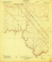
 1929 Karankawa Lake1929 Print · USGSThe Galveston and Brazoria county line meets the Gulf Coast in the late 1920s, revealing an era of undeveloped marshland and barrier island terrain. Researchers can trace the shifting shoreline of Galveston Island and identify historical landmarks like Karankawa Lake and Halls.
 - 1929 Map of Algoa
 1929 Algoa1929 Print · USGSThe coastal plains of Galveston County come into focus during the late twenties as the rail economy of Algoa took shape. Genealogists and historians can trace the early path of the Gulf Colorado and Santa Fe and locate unique geological Gas Bumps.
 - 1929 Map of Hitchcock
 1929 Hitchcock1929 Print · USGSCoastal Galveston County is captured here in the late twenties, showing the transition from inland prairie to marshy bayou. Genealogists and historians can trace early infrastructure along the Gulf Colorado and Santa Fe Railway near Hitchcock and Alta Loma.
 - 1932 Map of Algoa
 1932 Algoa1932 Print · USGSCoastal Texas in the early thirties centers on the railroad junction at Algoa, where steam-era transportation met the early automotive age. Genealogists and historians can trace the crossing of the Missouri Pacific and Gulf Colorado and Santa Fe near Dickinson Bayou.3 unique versions available
 - 1932 Map of Genoa
 1932 Genoa1932 Print · USGSSoutheast Texas coastal prairie life in the early thirties is defined by emerging aviation and rail corridors. Genealogists can trace family footprints near Genoa or find the early layout of Olcott (Ellington Field) and the Friendswood Bridge.3 unique versions available
 - 1932 Map of Hitchcock
 1932 Hitchcock1932 Print · USGSThe coastal prairies of Galveston County come into focus during the early thirties as rail and ranching shaped the landscape. Genealogists and local researchers can trace early settlements at Hitchcock and Alta Loma, or locate the Galveston Memorial Cemetery near the banks of Highland Bayou.2 unique versions available
 - 1932 Map of Mustang Bayou
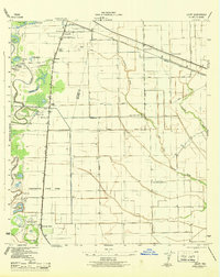
 1932 Mustang Bayou1932 Print · USGSThe coastal prairie of the upper Gulf Coast is captured here in the early thirties as local officials began formalizing land boundaries. Genealogists and historians can trace the early layout of Arcadia and the boundary between Galveston Co and Brazoria Co.2 unique versions available
 - 1933 Map of Karankawa Lake
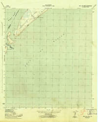
 1933 Karankawa Lake1933 Print · USGSThe Galveston coastline in the early 1930s is captured here, showing the unbridled geography of Galveston Island and the bay. Researchers can trace the original shoreline and water features like Karankawa Lake, Karankawa Point, and Lake Como.2 unique versions available
 - 1933 Map of San Luis Pass
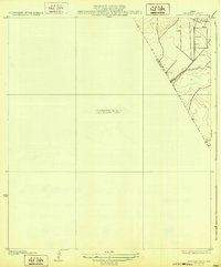
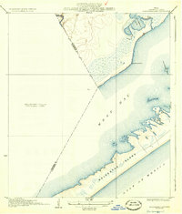
 1933 San Luis Pass1933 Print · USGSThe southwestern tip of Galveston Island is captured in the early 1930s, showing the maritime landscape before modern bridge connections. Trace the coastal defenses and tidal inlets of the era, from the San Luis Coast Guard station to the waters of West Bay.2 unique versions available
 - 1943 Map of San Luis Pass
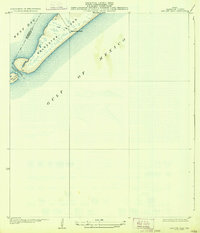
 1943 San Luis Pass1943 Print · USGSCoastal Galveston during the war years focused on maritime defense and navigation at the mouth of the bay. Researchers can trace the early layout of West Beach and the location of the San Luis Coast Guard Station at San Luis Pass.3 unique versions available
 - 1943 Map of Oyster Creek
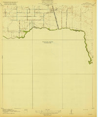
 1943 Oyster Creek1943 Print · USGSBrazoria County coastal life centered on the bayous and the railroad during the Second World War. Genealogists and historians can trace the foundations of Bastrop Beach or locate family sites like Hudgens Cem and Bethel Ch.2 unique versions available
 - 1943 Map of Rosharon
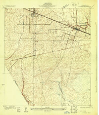
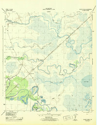
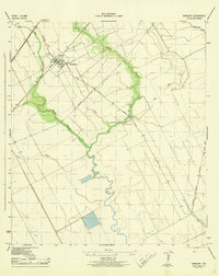
 1943 Rosharon1943 Print · USGSBrazoria County agricultural and institutional life comes into focus during the early 1940s, centered on the rail corridor through Rosharon. Local researchers can trace old burial sites at Pilgrim Cem and Daughters Cem or locate the sprawling Ramsey State Farm.2 unique versions available
 - 1943 Map of Jones Creek
 1943 Jones Creek1943 Print · USGSBrazoria County's coastal delta is captured here during the early 1940s as industry and infrastructure began to reshape the marshlands. Genealogists and local historians can trace family locations near Perry Landing, the Oakland Sch, and the Velasco Cem along the Brazos River.2 unique versions available
 - 1943 Map of Danbury
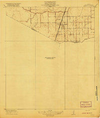
 1943 Danbury1943 Print · USGSBrazoria County coastal prairies are captured here during the early years of the war, centered on the rail hub at Danbury. Genealogists and researchers can trace local transport routes like Liverpool Road and industrial landmarks including the Pumping Station on Eagle Gully.2 unique versions available
 - 1943 Map of Mustang Bayou
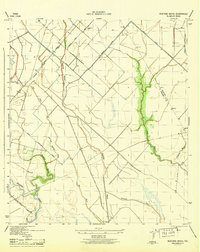 1943 Mustang Bayou1943 Print · USGSThe coastal prairie south of Houston during the 1940s reveals a landscape of tidal bayous and early irrigation. Genealogists and historians can trace the Missouri Pacific Road and find landmarks like the German Cem and Briscoe Canal.2 unique versions available
 - 1943 Map of Freeport
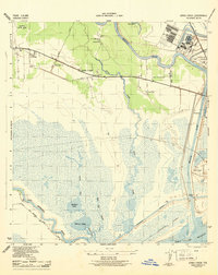
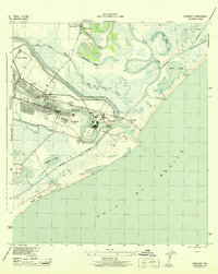 1943 Freeport1943 Print · USGSThe Texas coast near the mouth of the Brazos River comes into sharp focus during the early 1940s as industry and navigation expand. Researchers can trace the layout of Freeport, locate the Brazos River Lighthouse, and find the historic Quintana Cem along the gulf shore.2 unique versions available
 - 1943 Map of Juliff
 1943 Juliff1943 Print · USGSBrazoria County during the early 1940s shows a landscape of prison agriculture and coastal prairie drainage systems. Researchers can locate the Darrington State Farm complex, the Prison Cem, and rural schoolhouses like Mustang Sch and School No 20.2 unique versions available
 - 1943 Map of Carancahua Lake, 1952 Print
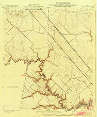
 1943 Carancahua Lake1952 Print · USGSThe Galveston and Brazoria county line met in the tidal marshes and open waters of the West Bay during the 1940s. Researchers can trace the early path of the Intracoastal Waterway and locate landmarks like Rattlesnake Mound and Boathouse Ruins.
 - 1943 Map of Cedar Lakes East, 1958 Print
 1943 Cedar Lakes East1958 Print · USGSThe Texas coast near the mouth of the San Bernard River was a landscape of deep-water channels and marshes in the early 1940s. Genealogists and local historians can locate the Ducroz Cem and early settlements like Owen and the Hotel.
 - 1943 Map of Angleton, 1958 Print
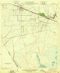
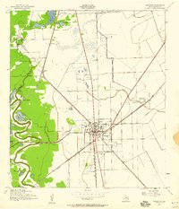 1943 Angleton1958 Print · USGSAngleton and the surrounding Brazoria County prairies are shown here during the early 1940s, when the regional economy centered on the railroad and riverside farming. Researchers can trace historic family landmarks such as Bearle Chapel, Revelation Cem, and the Texas Agricultural Experimental Station.
 - 1943 Map of Christmas Point, 1958 Print
 1943 Christmas Point1958 Print · USGSThe Texas Gulf Coast at Christmas Bay appears here in the 1940s, showing a landscape of barrier islands and marshy bayous. Trace the historic route of the Intracoastal Waterway and locate early landmarks like Christmas Point and Rattlesnake Point.
Showing maps 1-25 of 117
Top cities of Brazoria County
- Pearland historical maps
- Lake Jackson historical maps
- Alvin historical maps
- Angleton historical maps
- Iowa Colony historical maps
- Freeport historical maps
See more
Frequently asked questions
- What are the different types of historical maps available for Brazoria County?
- What is the oldest map of Brazoria County?
- Where can I purchase historical maps of Brazoria County for my home or office?
- Where can I download high-res historical maps of Brazoria County?
- Are there historical topographic maps available for Brazoria County?
- Is there historical aerial imagery available for Brazoria County?
- Where are historical maps of Brazoria County sourced from?