1940s Maps of Brazoria County, Texas
Explore 15 historic maps of Brazoria County from the 1940s. These maps offer a rare glimpse into what life looked like during the 1940s — showing old roads, neighborhoods, homes, and landmarks that have changed or disappeared over time.
Whether you're researching your family's past, planning a metal detecting trip, or studying how Brazoria County's landscape evolved across the 1940s, these high-resolution maps are a powerful tool for exploring the history of this region.
- Focus on a specific era: All maps on this page are from the 1940s, giving you a focused view of this time period.
- See what’s changed: Compare century-old streets, trails, and buildings to today's modern landscape using overlays and satellite layers.
- Research with precision: Use these maps for genealogy, historical research, land use analysis, or educational projects.
- View, download, or print: Maps are fully viewable online in high resolution, and can be downloaded or printed for your own records.
Start exploring Brazoria County's history through authentic maps from the 1940s. This is your window into the past.
Brazoria County, TX maps
(15)- 1943 Map of San Luis Pass
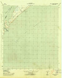 1943 San Luis Pass1943 Print · USGSCoastal Galveston during the war years focused on maritime defense and navigation at the mouth of the bay. Researchers can trace the early layout of West Beach and the location of the San Luis Coast Guard Station at San Luis Pass.3 unique versions available
 - 1943 Map of Oyster Creek
 1943 Oyster Creek1943 Print · USGSBrazoria County coastal life centered on the bayous and the railroad during the Second World War. Genealogists and historians can trace the foundations of Bastrop Beach or locate family sites like Hudgens Cem and Bethel Ch.2 unique versions available
 - 1943 Map of Rosharon
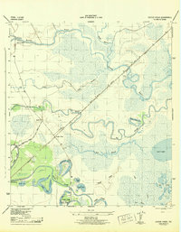
 1943 Rosharon1943 Print · USGSBrazoria County agricultural and institutional life comes into focus during the early 1940s, centered on the rail corridor through Rosharon. Local researchers can trace old burial sites at Pilgrim Cem and Daughters Cem or locate the sprawling Ramsey State Farm.2 unique versions available
 - 1943 Map of Jones Creek
 1943 Jones Creek1943 Print · USGSBrazoria County's coastal delta is captured here during the early 1940s as industry and infrastructure began to reshape the marshlands. Genealogists and local historians can trace family locations near Perry Landing, the Oakland Sch, and the Velasco Cem along the Brazos River.2 unique versions available
 - 1943 Map of Danbury
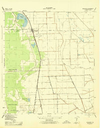
 1943 Danbury1943 Print · USGSBrazoria County coastal prairies are captured here during the early years of the war, centered on the rail hub at Danbury. Genealogists and researchers can trace local transport routes like Liverpool Road and industrial landmarks including the Pumping Station on Eagle Gully.2 unique versions available
 - 1943 Map of Mustang Bayou
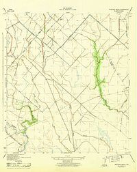 1943 Mustang Bayou1943 Print · USGSThe coastal prairie south of Houston during the 1940s reveals a landscape of tidal bayous and early irrigation. Genealogists and historians can trace the Missouri Pacific Road and find landmarks like the German Cem and Briscoe Canal.2 unique versions available
 - 1943 Map of Freeport
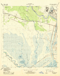
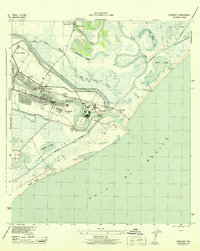 1943 Freeport1943 Print · USGSThe Texas coast near the mouth of the Brazos River comes into sharp focus during the early 1940s as industry and navigation expand. Researchers can trace the layout of Freeport, locate the Brazos River Lighthouse, and find the historic Quintana Cem along the gulf shore.2 unique versions available
 - 1943 Map of Juliff
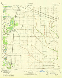 1943 Juliff1943 Print · USGSBrazoria County during the early 1940s shows a landscape of prison agriculture and coastal prairie drainage systems. Researchers can locate the Darrington State Farm complex, the Prison Cem, and rural schoolhouses like Mustang Sch and School No 20.2 unique versions available
 - 1943 Map of Carancahua Lake, 1952 Print
 1943 Carancahua Lake1952 Print · USGSThe Galveston and Brazoria county line met in the tidal marshes and open waters of the West Bay during the 1940s. Researchers can trace the early path of the Intracoastal Waterway and locate landmarks like Rattlesnake Mound and Boathouse Ruins.
 - 1943 Map of Cedar Lakes East, 1958 Print
 1943 Cedar Lakes East1958 Print · USGSThe Texas coast near the mouth of the San Bernard River was a landscape of deep-water channels and marshes in the early 1940s. Genealogists and local historians can locate the Ducroz Cem and early settlements like Owen and the Hotel.
 - 1943 Map of Angleton, 1958 Print
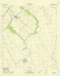
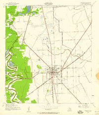 1943 Angleton1958 Print · USGSAngleton and the surrounding Brazoria County prairies are shown here during the early 1940s, when the regional economy centered on the railroad and riverside farming. Researchers can trace historic family landmarks such as Bearle Chapel, Revelation Cem, and the Texas Agricultural Experimental Station.
 - 1943 Map of Christmas Point, 1958 Print
 1943 Christmas Point1958 Print · USGSThe Texas Gulf Coast at Christmas Bay appears here in the 1940s, showing a landscape of barrier islands and marshy bayous. Trace the historic route of the Intracoastal Waterway and locate early landmarks like Christmas Point and Rattlesnake Point.
 - 1943 Map of Chocolate Bay, 1959 Print
 1943 Chocolate Bay1959 Print · USGSBrazoria County’s coastal marshes and bayous are frozen in time just as the mid-century industrial expansion took hold. Researchers can trace the rail sidings at Hoskins Mound, locate the old Peterson Landing, and follow the original path of the Intracoastal Waterway.
 - 1943 Map of Chocolate Bayou, 1959 Print
 1943 Chocolate Bayou1959 Print · USGSCoastal Brazoria County in the early 1940s was a landscape of winding waterways and early oil exploration. Researchers can trace the rail-and-river hub of Liverpool, find family names at Parker School, or locate the Gulf Coast Camp Meeting Ground.
 - 1943 Map of Snipe, 1959 Print
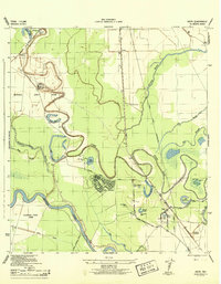 1943 Snipe1959 Print · USGSCoastal Brazoria County was undergoing a mid-century transformation as suburban development met traditional river bottomlands. Researchers can trace the early street grid of Lake Jackson, the sprawling Retrieve State Farm, and local landmarks like Trueona Ch and Wharton Cem.2 unique versions available
End of results
Showing maps 1-15 of 15
Top cities of Brazoria County
- Pearland historical maps
- Lake Jackson historical maps
- Alvin historical maps
- Angleton historical maps
- Iowa Colony historical maps
- Freeport historical maps
See more
Frequently asked questions
- What are the different types of historical maps available for Brazoria County?
- What is the oldest map of Brazoria County?
- Where can I purchase historical maps of Brazoria County for my home or office?
- Where can I download high-res historical maps of Brazoria County?
- Are there historical topographic maps available for Brazoria County?
- Is there historical aerial imagery available for Brazoria County?
- Where are historical maps of Brazoria County sourced from?