1950s Maps of Brazoria County, Texas
Explore 26 historic maps of Brazoria County from the 1950s. These maps offer a rare glimpse into what life looked like during the 1950s — showing old roads, neighborhoods, homes, and landmarks that have changed or disappeared over time.
Whether you're researching your family's past, planning a metal detecting trip, or studying how Brazoria County's landscape evolved across the 1950s, these high-resolution maps are a powerful tool for exploring the history of this region.
- Focus on a specific era: All maps on this page are from the 1950s, giving you a focused view of this time period.
- See what’s changed: Compare century-old streets, trails, and buildings to today's modern landscape using overlays and satellite layers.
- Research with precision: Use these maps for genealogy, historical research, land use analysis, or educational projects.
- View, download, or print: Maps are fully viewable online in high resolution, and can be downloaded or printed for your own records.
Start exploring Brazoria County's history through authentic maps from the 1950s. This is your window into the past.
Brazoria County, TX maps
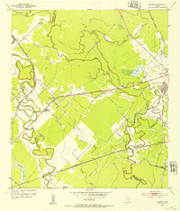
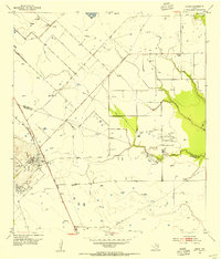
(26)- 1950 Map of Hitchcock
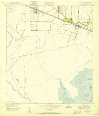 1950 Hitchcock1950 Print · USGSGalveston County settlement at mid-century is centered on the railroad corridor between the coastal prairies and the marshy bayous. Researchers can trace family-named routes like Bene Road and Jay Road or locate the Alta Loma Cemetery and Camp Wallace Military Reservation.
 - 1950 Map of Houston, 1953 Print
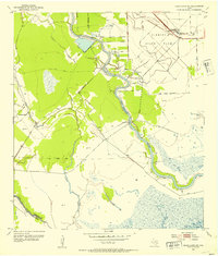
 1950 Houston1953 Print · USGSCoastal Texas in the early fifties reveals a landscape of massive civil engineering and industrial transit. Genealogists and researchers can trace the growth of the Houston suburbs and the maritime infrastructure of Galveston Bay, including the Gulf Freeway and the Texas City Dike.
 - 1951 Map of Bay City
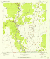
 1951 Bay City1951 Print · USGSThe mid-century Texas Gulf Coast comes to life in this survey of the delta region where the Brazos and Colorado Rivers meet the sea. Researchers can trace the industrial footprint of Freeport or locate family-named spots like Mangun and Hawkinsville.
 - 1952 Map of West Columbia
 1952 West Columbia1952 Print · USGSWest Columbia during the early 1950s reveals a landscape defined by its coastal prairie hydrology and booming petroleum industry. Researchers can trace the extensive West Columbia Oil Field and Tank Farm alongside rural landmarks like St Paul Ch.4 unique versions available
 - 1952 Map of Sweeny
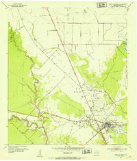
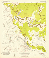
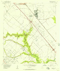
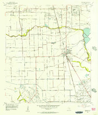
 1952 Sweeny1952 Print · USGSBrazoria County’s coastal prairies are shown here during a period of intense oil-sector growth in the early fifties. Genealogists and researchers can trace local landmarks like Washington Chapel, the settlement of Old Ocean, and the industrial footprint of the Tank Farm.3 unique versions available
 - 1952 Map of Danciger, 1953 Print
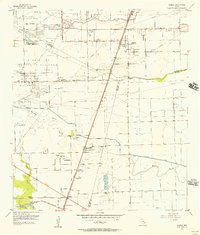
 1952 Danciger1953 Print · USGSCoastal Texas industry and rural life meet in the early fifties as the Pledger Gas Field expands across the Brazoria County bayous. Genealogists and historians can trace family-named sites like Brown Cem and St Mary Ch near the banks of Dance Bayou.3 unique versions available
 - 1952 Map of Ashwood, 1953 Print
 1952 Ashwood1953 Print · USGSThe mid-century Texas Gulf Coast comes to life in this survey of the petroleum-rich coastal plains at the Matagorda and Brazoria county line. Researchers can trace the industrial landscape of the Old Ocean Oil Field and locate rural landmarks like Free System Cem and the Southern Pacific rail line.4 unique versions available
 - 1952 Map of Cedar Lane NE, 1953 Print
 1952 Cedar Lane NE1953 Print · USGSBrazoria County at mid-century reveals a landscape defined by state land use and river-based industry along the Gulf Coast. Genealogists and historians can trace local landmarks like Jerusalem Sch, the rural Galilee Ch, and the industrial Sulphur Plant.3 unique versions available
 - 1952 Map of Cedar Lakes West, 1953 Print
 1952 Cedar Lakes West1953 Print · USGSThe Matagorda and Brazoria county line met the Texas coast in the early fifties amidst a labyrinth of marshes and industrial canals. Trace the engineering of the Intracoastal Waterway and locate remote landmarks like the Pontoon Bridge and early coastal Oil Wells.4 unique versions available
 - 1952 Map of East Columbia, 1953 Print
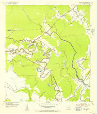
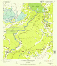 1952 East Columbia1953 Print · USGSThe Brazos River bottomlands are captured here in the early fifties during a period of significant water engineering. You can trace family history at Munson Cem or locate old sites like Mt Zion Ch and the newly forming Mann Lake.3 unique versions available
 - 1952 Map of Bay City NE, 1953 Print
 1952 Bay City NE1953 Print · USGSCoastal Texas prairie life in the early fifties is mapped here along the winding banks of Caney Creek and the county line. Researchers can locate many family burial grounds and country parishes, from Matthews Cem to Vine Grove Ch and Mt Pilgrim Ch.2 unique versions available
 - 1952 Map of Brazoria, 1953 Print
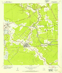
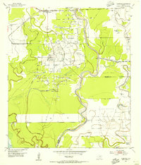
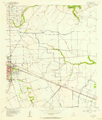
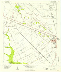
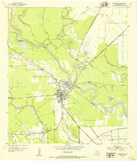 1952 Brazoria1953 Print · USGSBrazoria and the surrounding coastal prairies are captured here in the early fifties, showing the shift from river-based settlement to a rail-centered economy. Trace family roots at Zion Temple Cem, Mims Sch, or the historic Old Brazoria townsite.3 unique versions available
 - 1952 Map of Cedar Lane, 1953 Print
 1952 Cedar Lane1953 Print · USGSCoastal Texas at the start of the 1950s reveals a landscape of winding bayous and rural schoolhouses along the Matagorda county line. Genealogists can trace family footprints near Linnville, Jaden Cem, and the old Kennedy Sch.4 unique versions available
 - 1953 Map of Guy, 1954 Print
 1953 Guy1954 Print · USGSFort Bend County at the start of the 1950s was a landscape defined by the intersection of cattle, crops, and crude oil. Genealogists and local historians can trace family locations near the Guy Cem, the settlement of Mooredale, and the active Damon Mound Oil Field.4 unique versions available
 - 1953 Map of Damon, 1954 Print
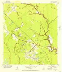
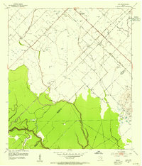
 1953 Damon1954 Print · USGSBrazoria County oil production and coastal prairie life are in full view during the early fifties. Genealogists and industrial historians can trace the Nash Dome Oil Field, locate the Woodrow School, and find family landmarks near Damon Mound.3 unique versions available
 - 1953 Map of Otey, 1955 Print
 1953 Otey1955 Print · USGSCoastal Texas ranching and the oil industry converge along the Brazos River in the early fifties. Researchers can trace the massive Ramsey State Prison Farm complex, the Orozimbo Historical Marker, and small outposts like Guenther Station.4 unique versions available
 - 1953 Map of Thompsons, 1955 Print
 1953 Thompsons1955 Print · USGSThe Brazos River valley in the early fifties shows a landscape transformed by petroleum at Humble Camp and Thompsons Ridge Field. Trace family roots near Thompsons and locate the Sacred Heart Church or the Darrington State Prison Farm.3 unique versions available
 - 1955 Map of Friendswood, 1957 Print
 1955 Friendswood1957 Print · USGSSoutheastern Texas in the mid-fifties reveals an landscape of emerging aviation and oil production. Trace family landmarks and industrial roots at Ellington Air Force Base, the Friendswood Oil Field, and Whitcomb Cem.3 unique versions available
 - 1955 Map of Pearland, 1957 Print
 1955 Pearland1957 Print · USGSThe mid-century Texas coastal plain near Pearland reveals a landscape of developing suburbs and active petroleum drilling. Trace the growth of Skyscraper Shadows, locate family sites at Dagg Cem, or study the industrial footprint of the Manvel Field.2 unique versions available
 - 1955 Map of Almeda, 1957 Print
 1955 Almeda1957 Print · USGSIn the mid-fifties, this portion of the Texas coastal plain was a mix of prison farms, oil fields, and rural settlements. Genealogists can locate family names and burial sites at Beth Jacob Cem or Arcola-Fresno Cem and trace the old Missouri Pacific rail corridor.3 unique versions available
 - 1956 Map of Algoa, 1957 Print
 1956 Algoa1957 Print · USGSThe Galveston and Brazoria county lines meet in the 1950s amidst a landscape of expanding oil fields and irrigation canals. Genealogists can trace family names near Magnolia Cem or follow the rail junction at Alvin and the smaller depot at Algoa.4 unique versions available
 - 1956 Map of Manvel, 1957 Print
 1956 Manvel1957 Print · USGSBrazoria County in the mid-fifties is captured here as a landscape of oil derricks and rice canals between the growing towns of Manvel and Alvin. Genealogists and local historians can trace the foundations of Consolidated Schools, find the Manvel Cem, or locate the Hastings Siding along the Santa Fe line.2 unique versions available
 - 1956 Map of Houston, 1963 Print
 1956 Houston1963 Print · USGSSoutheast Texas in the mid-fifties is captured here as a powerhouse of oil and maritime trade. Genealogists and historians can trace the foundations of Houston and its ports, alongside landmarks like the Rice Institute and the Spindletop Oil Field.2 unique versions available
 - 1956 Map of Bay City, 1964 Print
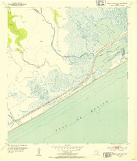
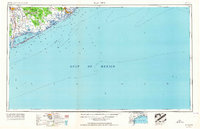 1956 Bay City1964 Print · USGSThe Texas Gulf Coast comes into focus in the mid-1950s, showing the intricate bayous and coastal settlements from Bay City to Freeport. Researchers can trace the legacy of shoreline communities like Sargent, Matagorda Beach, and Hawkinsville before modern coastal changes.2 unique versions available
 - 1958 Map of Bay City
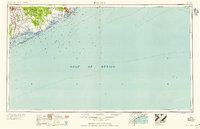 1958 Bay City1958 Print · USGSThe Texas Gulf Coast in the late fifties shows a landscape of growing petrochemical plants and intricate wetlands. Genealogists and historians can trace the paths of the Missouri Pacific railroad through Bay City or locate old settlements like Hinkle Ferry and Hawkinsville.
Showing maps 1-25 of 26
Top cities of Brazoria County
- Pearland historical maps
- Lake Jackson historical maps
- Alvin historical maps
- Angleton historical maps
- Iowa Colony historical maps
- Freeport historical maps
See more
Frequently asked questions
- What are the different types of historical maps available for Brazoria County?
- What is the oldest map of Brazoria County?
- Where can I purchase historical maps of Brazoria County for my home or office?
- Where can I download high-res historical maps of Brazoria County?
- Are there historical topographic maps available for Brazoria County?
- Is there historical aerial imagery available for Brazoria County?
- Where are historical maps of Brazoria County sourced from?