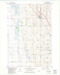
1981 Map of Rothsay
USGS Topo · Published 1981About this map
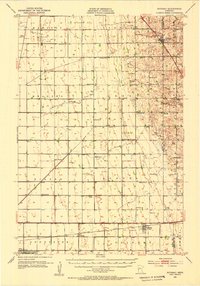
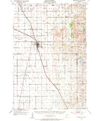
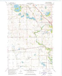
Rothsay serves as the primary hub of this 1981 survey, straddling the county line where the Burlington Northern railroad runs parallel to the highway. The town's layout includes a trailer park and several religious landmarks such as Our Saviors Cem, while the surrounding landscape is defined by the transition from agricultural fields to specialized conservation zones. Large sections of the terrain are dedicated to environmental management, including the National Waterfowl Production Area and the Rothsay State Wildlife Management Area near Lawndale Slough. Local governance and community life are marked by the presence of a Townhall in Tanberg and another in Akron. The southern reaches near the Akron settlement are dotted with Gravel Pits and the German Cem, illustrating a rural economy and history rooted in both the earth and the diverse immigrant congregations of the prairie.
Find a feature on this map
24 named features on this map. Tap any name to fly to it.
Don’t see what you’re looking for? This feature index may not catch every label — zoom into the map to look around manually.
Map Details
Editions of this 1981 Rothsay Map
This is the sole edition of this map. No revisions or reprints were ever made.
Other maps of this area

1913 · Fergus Falls
USGS Topo · 1:62,500

1914 · Pelican Rapids
USGS Topo · 1:62,500
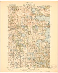
1917 · Pelican Rapids
USGS Topo · 1:62,500
1919 · Rothsay
USGS Topo · 1:62,500
1919 · Barnesville
USGS Topo · 1:62,500
1951 · Rothsay
USGS Topo · 1:62,500
1952 · Barnesville
USGS Topo · 1:62,500

1953 · Fargo
USGS Topo · 1:250,000

1956 · Fargo
USGS Topo · 1:250,000
1966 · Carlisle
USGS Topo · 1:24,000