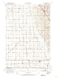
1951 Map of Rothsay
USGS Topo · Published 1957About this map
The border of Wilkin and Otter Tail counties is defined by a landscape of small rural schoolhouses and rail connections in the early 1950s. The village of Rothsay sits at a major junction of the Great Northern railroad, while further south, the settlement of Everdell and the Foxhome Ch mark the path of the Northern Pacific line. This survey is notable for its dense network of numbered school districts, such as School No 7 and School No 260, indicating a well-populated agricultural community at mid-century.
Find a feature on this map
41 named features on this map. Tap any name to fly to it.
Don’t see what you’re looking for? This feature index may not catch every label — zoom into the map to look around manually.
Map Details
Editions of this 1951 Rothsay Map
3 editions found

Other maps of this area

1895 · Fargo
USGS Topo · 1:125,000

1897 · Fargo
USGS Topo · 1:125,000

1904 · Wahpeton
USGS Topo · 1:125,000

1910 · Wendell
USGS Topo · 1:62,500

1913 · Fergus Falls
USGS Topo · 1:62,500

1913 · Wendell
USGS Topo · 1:62,500

1914 · Pelican Rapids
USGS Topo · 1:62,500

1917 · Pelican Rapids
USGS Topo · 1:62,500

1919 · Rothsay
USGS Topo · 1:62,500

1919 · Barnesville
USGS Topo · 1:62,500