
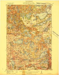
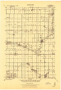
1914 Map of Pelican Rapids
USGS Topo · Published 1949About this map
Pelican Rapids serves as the primary hub in this early 20th-century landscape of lakes and prairie townships. The Northern Pacific railroad tracks provide the central artery through the region, connecting the rural communities of Scambler and Pelican. The map reveals a dense network of country education, marked by a high concentration of schoolhouses like Grove Lake School and Rollag School, reflecting the era's decentralized settlement patterns. Long before the modern development of these shorelines, features like Dunns Resort and Oak Lodge indicate the early roots of the local recreation economy.
Find a feature on this map
88 named features on this map. Tap any name to fly to it.
Don’t see what you’re looking for? This feature index may not catch every label — zoom into the map to look around manually.
Map Details
Editions of this 1914 Pelican Rapids Map
This is the sole edition of this map. No revisions or reprints were ever made.
Other maps of this area

1912 · Vergas
USGS Topo · 1:62,500

1913 · Fergus Falls
USGS Topo · 1:62,500
1915 · Underwood
USGS Topo · 1:62,500

1915 · Vergas
USGS Topo · 1:62,500
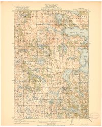
1917 · Pelican Rapids
USGS Topo · 1:62,500
1919 · Rothsay
USGS Topo · 1:62,500
1919 · Barnesville
USGS Topo · 1:62,500
1919 · Hawley
USGS Topo · 1:62,500
1951 · Rothsay
USGS Topo · 1:62,500
1952 · Barnesville
USGS Topo · 1:62,500