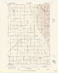
1951 Map of Rothsay
USGS Topo · Published 1957About this map
The intersection of the Great Northern and Northern Pacific railroads anchors the agricultural landscape of this prairie region during the early 1950s. At the southern edge, the village of Foxhome serves as a local hub near the Foxhome Cem, while Everdell and Rothsay mark important points along the rail lines. The map reveals a highly organized rural infrastructure, documented by an exceptional number of numbered country schools, such as School No 7 and School No 56, which once served the surrounding farmsteads.
Find a feature on this map
40 named features on this map. Tap any name to fly to it.
Don’t see what you’re looking for? This feature index may not catch every label — zoom into the map to look around manually.
Map Details
Editions of this 1951 Rothsay Map
3 editions found

Other maps of this area

1895 · Fargo
USGS Topo · 1:125,000

1897 · Fargo
USGS Topo · 1:125,000

1904 · Wahpeton
USGS Topo · 1:125,000

1910 · Wendell
USGS Topo · 1:62,500

1913 · Fergus Falls
USGS Topo · 1:62,500

1913 · Wendell
USGS Topo · 1:62,500

1914 · Pelican Rapids
USGS Topo · 1:62,500

1917 · Pelican Rapids
USGS Topo · 1:62,500

1919 · Rothsay
USGS Topo · 1:62,500

1919 · Barnesville
USGS Topo · 1:62,500