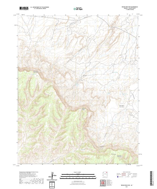
2021 Map of Rough Rock NW
USGS Topo · Published 2021About this map
Pain in the Back Canyon and the high desert terrain of the Navajo Nation define this northern Arizona landscape. The map reveals a network of vital water sources in an arid environment, including Yellow Man Spring, Burro Spring, and Red Tree Spring. These features, along with drainage systems like Oraibi Wash and Burro Wash, highlight the historical importance of water for settlement and transit through the canyons.
Find a feature on this map
25 named features on this map. Tap any name to fly to it.
Don’t see what you’re looking for? This feature index may not catch every label — zoom into the map to look around manually.
Map Details
Editions of this 2021 Rough Rock NW Map
This is the sole edition of this map. No revisions or reprints were ever made.
Other maps of this area

1883 · Marsh Pass
USGS Topo · 1:250,000

1892 · Marsh Pass
USGS Topo · 1:250,000

1892 · Canyon De Chelly
USGS Topo · 1:250,000

1954 · Shiprock
USGS Topo · 1:250,000

1956 · Marble Canyon
USGS Topo · 1:250,000

1958 · Shiprock
USGS Topo · 1:250,000

1959 · Shiprock
USGS Topo · 1:250,000

1959 · Marble Canyon
USGS Topo · 1:250,000

1961 · Marble Canyon
USGS Topo · 1:250,000
1968 · Hole In Rock Valley
USGS Topo · 1:24,000