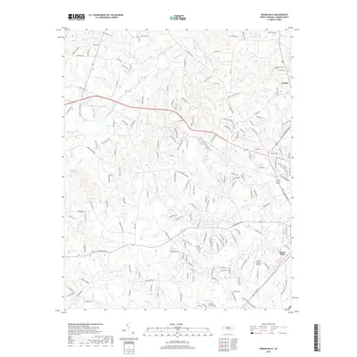
2019 Map of Rowan Mills
USGS Topo · Published 2019About this map
Rowan Mills and the nearby Franklin settlement define the human geography of this North Carolina landscape, where industrial infrastructure meets a dense network of Piedmont watercourses. The presence of the Rowan County Airport south of these communities highlights the area's development as a regional hub. A intricate system of creeks and branches, including Grants Creek, Second Creek, and the curiously named Jump and Run Branch, carves through the terrain, historically influencing the placement of early homesteads and mills. The map detail shows a transition from structured residential pockets and commercial aviation sites to rural land characterized by family-named roads like Ernest Miller Road and Kluttz Road, illustrating the persistent agrarian roots and family lineages of Rowan County even as suburban expansion progresses.
Find a feature on this map
178 named features on this map. Tap any name to fly to it.
Don’t see what you’re looking for? This feature index may not catch every label — zoom into the map to look around manually.
Map Details
Editions of this 2019 Rowan Mills Map
This is the sole edition of this map. No revisions or reprints were ever made.
Other maps of this area

1893 · Statesville
USGS Topo · 1:125,000

1950 · Churchland
USGS Topo · 1:24,000

1951 · Churchland
USGS Topo · 1:24,000

1953 · Charlotte
USGS Topo · 1:250,000

1954 · Charlotte
USGS Topo · 1:250,000

1960 · Charlotte
USGS Topo · 1:250,000

1962 · Charlotte
USGS Topo · 1:250,000
1962 · Salisbury
USGS Topo · 1:24,000
1962 · Rockwell
USGS Topo · 1:24,000

1969 · Cooleemee
USGS Topo · 1:24,000