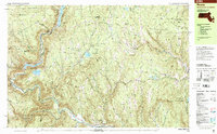
1998 Map of Rowe
USGS Topo · Published 2001About this map
Monroe Bridge and Rowe sit within a landscape heavily shaped by industrial utility and timbered conservation at the turn of the millennium. The Deerfield River cuts a deep gorge through the center of this terrain, supporting the Sherman Reservoir and the Upper Reservoir Bear Swamp as part of the Bear Swamp Pumped Storage Project. Traces of older industry are found at the Davis Mine and the Hoosac Tunnel entrance, while the modern era is marked by a Nuclear Powerplant and associated Substation.
Find a feature on this map
64 named features on this map. Tap any name to fly to it.
Don’t see what you’re looking for? This feature index may not catch every label — zoom into the map to look around manually.
Map Details
Editions of this 1998 Rowe Map
This is the sole edition of this map. No revisions or reprints were ever made.
Other maps of this area

1886 · Greylock
USGS Topo · 1:62,500

1886 · Hawley
USGS Topo · 1:62,500

1889 · Wilmington
USGS Topo · 1:62,500

1890 · Hawley
USGS Topo · 1:62,500

1890 · Greenfield
USGS Topo · 1:62,500

1891 · Wilmington
USGS Topo · 1:62,500

1891 · Greylock
USGS Topo · 1:62,500

1891 · Brattleboro
USGS Topo · 1:62,500

1893 · Brattleboro
USGS Topo · 1:62,500

1893 · Greylock
USGS Topo · 1:62,500