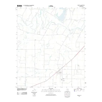
2010 Map of Rowena
USGS Topo · Published 2010About this map
Rowena anchors this portion of Runnels County, situated south of the meandering Colorado River. The community's local history is anchored by its clustered burial sites, including the Evergreen Cemetery, Saint Josephs Cemetery, and Protestant Cemetery, providing a clear map of the area's genealogical footprint. The landscape is a mix of agricultural plains and industrial sites, evidenced by the Rowena Oil Field to the east and the Kristoff School to the northwest. Numerous watercourses such as Indian Creek, Rocky Creek, and Antelope Creek carve through the terrain, eventually feeding into the river. A network of country roads, including River Rd and Pony Rd, connects these rural homesteads and schools, reflecting the enduring 20th-century settlement pattern of West Texas ranching and oil country.
Find a feature on this map
43 named features on this map. Tap any name to fly to it.
Don’t see what you’re looking for? This feature index may not catch every label — zoom into the map to look around manually.
Map Details
Editions of this 2010 Rowena Map
This is the sole edition of this map. No revisions or reprints were ever made.
Other maps of this area

1891 · Hayrick
USGS Topo · 1:125,000

1892 · Ballinger
USGS Topo · 1:125,000

1894 · Hayrick
USGS Topo · 1:125,000

1921 · Baker Flat
USGS Topo · 1:31,680

1921 · Hatchel
USGS Topo · 1:31,680

1921 · Lowake
USGS Topo · 1:31,680

1921 · Maverick
USGS Topo · 1:31,680

1921 · Quarry Creek
USGS Topo · 1:31,680

1921 · Spur Creek
USGS Topo · 1:31,680

1921 · Rowena
USGS Topo · 1:31,680