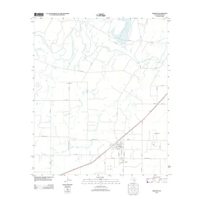
2012 Map of Rowena
USGS Topo · Published 2012About this map
The settlement of Rowena serves as the focal point of this West Texas survey, where a grid of residential streets including Park St and Victor St meets the rural agricultural landscape. The town's community history is reflected in the clustering of three distinct burial grounds to the southeast: Evergreen Cem, Saint Josephs Cem, and the Protestant Cem. This concentration suggests a long-standing local heritage tied to this corner of Runnels County.
Find a feature on this map
48 named features on this map. Tap any name to fly to it.
Don’t see what you’re looking for? This feature index may not catch every label — zoom into the map to look around manually.
Map Details
Editions of this 2012 Rowena Map
This is the sole edition of this map. No revisions or reprints were ever made.
Other maps of this area

1891 · Hayrick
USGS Topo · 1:125,000

1892 · Ballinger
USGS Topo · 1:125,000

1894 · Hayrick
USGS Topo · 1:125,000

1921 · Baker Flat
USGS Topo · 1:31,680

1921 · Hatchel
USGS Topo · 1:31,680

1921 · Lowake
USGS Topo · 1:31,680

1921 · Maverick
USGS Topo · 1:31,680

1921 · Quarry Creek
USGS Topo · 1:31,680

1921 · Spur Creek
USGS Topo · 1:31,680

1921 · Rowena
USGS Topo · 1:31,680