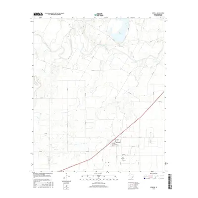
2016 Map of Rowena
USGS Topo · Published 2016About this map
Rowena anchors the southeastern portion of this Runnels County landscape, situated along a prominent transportation corridor that bisects the ranching and agricultural terrain of West Texas. The settlement's grid is defined by streets such as Main St and Bennie St, while the surrounding countryside is marked by numerous family-named roads and critical water sources. To the north, the Colorado River meanders through the territory, joined by tributaries like Antelope Cr and Valley Cr. For genealogists and local historians, the map provides precise locations for several community landmarks, including Evergreen Cem, Saint Josephs Cem, and Protestant Cem. The geography is further shaped by local water management and recreation at Ballinger City Lake and Kuhn Lake, reflecting the vital importance of water resources in this part of the state.
Find a feature on this map
50 named features on this map. Tap any name to fly to it.
Don’t see what you’re looking for? This feature index may not catch every label — zoom into the map to look around manually.
Map Details
Editions of this 2016 Rowena Map
This is the sole edition of this map. No revisions or reprints were ever made.
Other maps of this area

1891 · Hayrick
USGS Topo · 1:125,000

1892 · Ballinger
USGS Topo · 1:125,000

1894 · Hayrick
USGS Topo · 1:125,000

1921 · Baker Flat
USGS Topo · 1:31,680

1921 · Hatchel
USGS Topo · 1:31,680

1921 · Lowake
USGS Topo · 1:31,680

1921 · Maverick
USGS Topo · 1:31,680

1921 · Quarry Creek
USGS Topo · 1:31,680

1921 · Spur Creek
USGS Topo · 1:31,680

1921 · Rowena
USGS Topo · 1:31,680