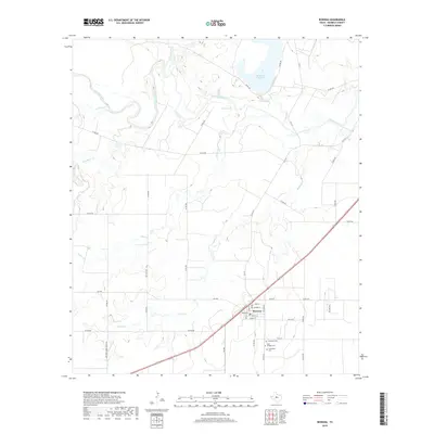
2019 Map of Rowena
USGS Topo · Published 2019About this map
Rowena anchors the southeastern portion of this Runnels County landscape, situated along a prominent highway corridor where the local street grid includes Main St and School St. This region of West Texas is defined by its drainages, where the Colorado River meanders across the northern reaches, joined by tributaries such as Valley Creek and Antelope Creek. The terrain is marked by essential water management features including Ballinger City Lake and Kuhn Lake, reflecting the agricultural and municipal needs of the high plains.
Find a feature on this map
46 named features on this map. Tap any name to fly to it.
Don’t see what you’re looking for? This feature index may not catch every label — zoom into the map to look around manually.
Map Details
Editions of this 2019 Rowena Map
This is the sole edition of this map. No revisions or reprints were ever made.
Other maps of this area

1891 · Hayrick
USGS Topo · 1:125,000

1892 · Ballinger
USGS Topo · 1:125,000

1894 · Hayrick
USGS Topo · 1:125,000

1921 · Baker Flat
USGS Topo · 1:31,680

1921 · Hatchel
USGS Topo · 1:31,680

1921 · Lowake
USGS Topo · 1:31,680

1921 · Maverick
USGS Topo · 1:31,680

1921 · Quarry Creek
USGS Topo · 1:31,680

1921 · Spur Creek
USGS Topo · 1:31,680

1921 · Rowena
USGS Topo · 1:31,680