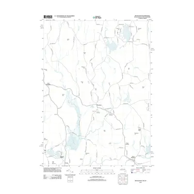
2012 Map of Royalston
USGS Topo · Published 2012About this map
Royalston and its surrounding hill country are defined by a complex network of brooks and dramatic cascades. This area of Worcester County is punctuated by significant water features, including Spirit Falls, Doane Falls, and Royalston Falls, reflecting the steep elevation changes across the plateau. The settlement pattern remains centered on the traditional village at Royalston, with satellite communities like West Royalston, South Royalston, and Fryeville serving as anchors for the local geography. Local history and genealogy are anchored by several burial grounds, including the Royalston Center Cem and Riverside Cem. Large tracts of protected land, such as the Birch Hill Wildlife Area, preserve the character of the landscape around Tully Lake and Laurel Lake, while numerous named heights like Chestnut Hill and Jacob Hill provide a sense of the upland terrain that shaped the development of this northern Massachusetts community.
Find a feature on this map
126 named features on this map. Tap any name to fly to it.
Don’t see what you’re looking for? This feature index may not catch every label — zoom into the map to look around manually.
Map Details
Editions of this 2012 Royalston Map
This is the sole edition of this map. No revisions or reprints were ever made.
Other maps of this area

1887 · Warwick
USGS Topo · 1:62,500

1887 · Winchendon
USGS Topo · 1:62,500

1889 · Warwick
USGS Topo · 1:62,500

1890 · Winchendon
USGS Topo · 1:62,500

1894 · Winchendon
USGS Topo · 1:62,500

1894 · Warwick
USGS Topo · 1:62,500

1898 · Monadnock
USGS Topo · 1:62,500

1898 · Keene
USGS Topo · 1:62,500

1932 · Warwick
USGS Topo · 1:48,000

1932 · Winchendon
USGS Topo · 1:48,000