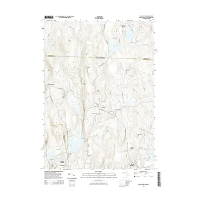
2015 Map of Royalston
USGS Topo · Published 2015About this map
Royalston sits at a geographic crossroads where the Massachusetts-New Hampshire border meets the line between Worcester and Franklin Counties. The landscape is defined by the high ground of Chestnut Hill, Prospect Hill, and Tully Mtn, with drainage moving through a complex system of brooks and rivers including the East Branch Tully River and the Millers River in the south. This modern survey reflects a region deeply rooted in its cemetery locations, such as Royalston Center Cem and Chestnut Hill Cem, which serve as vital markers for local genealogists. Settlement patterns are concentrated at West Royalston, Fryeville, and South Royalston, while the central village is anchored by Little Pond and the cascading waters of Doane Falls. The map also captures recreation and social landmarks like Camp Caravan and Sportsman Pond, illustrating how the historical upland farmstead terrain has evolved into a corridor of natural conservation and scattered residential clusters.
Find a feature on this map
112 named features on this map. Tap any name to fly to it.
Don’t see what you’re looking for? This feature index may not catch every label — zoom into the map to look around manually.
Map Details
Editions of this 2015 Royalston Map
This is the sole edition of this map. No revisions or reprints were ever made.
Other maps of this area

1887 · Warwick
USGS Topo · 1:62,500

1887 · Winchendon
USGS Topo · 1:62,500

1889 · Warwick
USGS Topo · 1:62,500

1890 · Winchendon
USGS Topo · 1:62,500

1894 · Winchendon
USGS Topo · 1:62,500

1894 · Warwick
USGS Topo · 1:62,500

1898 · Monadnock
USGS Topo · 1:62,500

1898 · Keene
USGS Topo · 1:62,500

1932 · Warwick
USGS Topo · 1:48,000

1932 · Winchendon
USGS Topo · 1:48,000