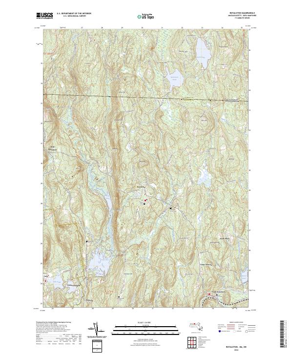
2024 Map of Royalston
USGS Topo · Published 2024About this map
Royalston and its outlying villages sit amidst a high-relief landscape of New England hills and valley water systems along the New Hampshire Massachusetts border. This modern topographic record reveals the complex drainage of the Tully River and Millers River, highlighting how historic settlements like South Royalston and Fryeville developed around these vital watercourses. The town's heritage is anchored by sites such as the Old Centre Cem and Chestnut Hill Cem, while the rugged northern terrain is marked by peaks like Brigham Hill and Grant Hill. Large recreational and natural features including Tully Lake, Laurel Lake, and the Metacomet-Monadnock Trl show how the region's 19th-century industrial and agricultural footprint has transitioned into a landscape defined by conservation and topography.
Find a feature on this map
119 named features on this map. Tap any name to fly to it.
Don’t see what you’re looking for? This feature index may not catch every label — zoom into the map to look around manually.
Map Details
Editions of this 2024 Royalston Map
This is the sole edition of this map. No revisions or reprints were ever made.
Other maps of this area

1887 · Warwick
USGS Topo · 1:62,500

1887 · Winchendon
USGS Topo · 1:62,500

1889 · Warwick
USGS Topo · 1:62,500

1890 · Winchendon
USGS Topo · 1:62,500

1894 · Winchendon
USGS Topo · 1:62,500

1894 · Warwick
USGS Topo · 1:62,500

1898 · Monadnock
USGS Topo · 1:62,500

1898 · Keene
USGS Topo · 1:62,500

1932 · Warwick
USGS Topo · 1:48,000

1932 · Winchendon
USGS Topo · 1:48,000