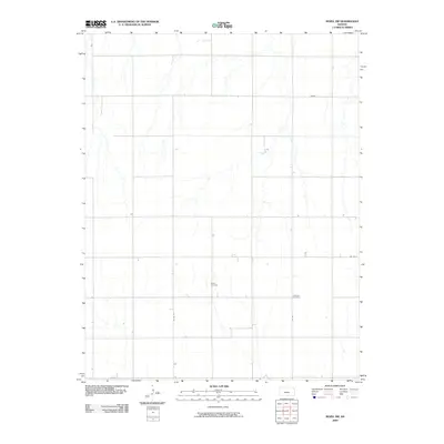
2009 Map of Rozel SW
USGS Topo · Published 2009About this map
The agricultural landscape of Pawnee County is characterized by a precise grid of rural routes and significant local heritage sites. At the center of this rural stretch lies the Salem Cemetery, a quiet landmark alongside Co Rd 12 that serves as a touchstone for local family history. To the east, the Lutheran Cemetery marks another point of settlement and community continuity near Co Rd 7. These locations, positioned within a network of drainage ways and intermittent streams, reflect the enduring structure of the Kansas plains. A small industrial footprint is noted with a (Gravel) extraction area in the northeastern quadrant, highlighting the intersection of the local economy with the physical environment. The map provides a clear record of the county road system, including major thoroughfares like Co Rd 6 and Co Rd 13, which define the section lines of this farming region.
Find a feature on this map
7 named features on this map. Tap any name to fly to it.
Don’t see what you’re looking for? This feature index may not catch every label — zoom into the map to look around manually.
Map Details
Editions of this 2009 Rozel SW Map
This is the sole edition of this map. No revisions or reprints were ever made.
Other maps of this area

1889 · Larned
USGS Topo · 1:125,000

1889 · Kinsley
USGS Topo · 1:125,000

1891 · Larned
USGS Topo · 1:125,000

1892 · Ness
USGS Topo · 1:125,000

1892 · Kinsley
USGS Topo · 1:125,000

1892 · Spearville
USGS Topo · 1:125,000

1894 · Spearville
USGS Topo · 1:125,000

1894 · Kinsley
USGS Topo · 1:125,000

1894 · Ness
USGS Topo · 1:125,000

1955 · Great Bend
USGS Topo · 1:250,000