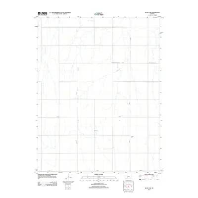
2012 Map of Rozel SW
USGS Topo · Published 2012About this map
Agricultural patterns and rural burial grounds define this portion of Pawnee County in the early 21st century. The landscape is structured by a strict section-line grid of county roads, including Co Rd-1, Co Rd-13, and Co Rd-6, which facilitate the movement of equipment across the Kansas plains. Amidst these expansive fields, two distinct sites of local heritage remain preserved: the Salem Cem and the Lutheran Cem. These small cemeteries serve as primary markers of the area's pioneer genealogy and earlier community centers that once dotted the prairie. Occasional breaks in the formal grid occur where an Unmaintained Field Trl cuts through the terrain, suggesting older routes or access to more isolated farm acreage. The survey captures a moment when the region's transport network was anchored by Co Hwy-12 and Co Rd-12 along the southern margin.
Find a feature on this map
8 named features on this map. Tap any name to fly to it.
Don’t see what you’re looking for? This feature index may not catch every label — zoom into the map to look around manually.
Map Details
Editions of this 2012 Rozel SW Map
This is the sole edition of this map. No revisions or reprints were ever made.
Other maps of this area

1889 · Larned
USGS Topo · 1:125,000

1889 · Kinsley
USGS Topo · 1:125,000

1891 · Larned
USGS Topo · 1:125,000

1892 · Ness
USGS Topo · 1:125,000

1892 · Kinsley
USGS Topo · 1:125,000

1892 · Spearville
USGS Topo · 1:125,000

1894 · Spearville
USGS Topo · 1:125,000

1894 · Kinsley
USGS Topo · 1:125,000

1894 · Ness
USGS Topo · 1:125,000

1955 · Great Bend
USGS Topo · 1:250,000