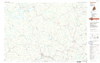
1986 Map of Rumford
USGS Topo · Published 1986About this map
Rumford and Mexico sit at the confluence of the Androscoggin River and Swift River, anchoring a 1980s landscape defined by timber-rich highlands and deep glacial lakes. This survey captures the interior of Western Maine as it transitioned from traditional river-and-rail economies toward modern conservation and recreational land use. Significant industrial and educational infrastructure is visible, including the Maine Central RR lines serving the southern valley and the campus of Farmington State College.
Find a feature on this map
100 named features on this map. Tap any name to fly to it.
Don’t see what you’re looking for? This feature index may not catch every label — zoom into the map to look around manually.
Map Details
Editions of this 1986 Rumford Map
This is the sole edition of this map. No revisions or reprints were ever made.
Other maps of this area

1892 · Augusta
USGS Topo · 1:62,500

1893 · Gorham
USGS Topo · 1:62,500

1894 · Norridgewock
USGS Topo · 1:62,500

1896 · Gorham
USGS Topo · 1:62,500

1898 · Norridgewock
USGS Topo · 1:62,500

1903 · Bingham
USGS Topo · 1:62,500

1904 · Anson
USGS Topo · 1:62,500

1905 · Bingham
USGS Topo · 1:62,500

1910 · Livermore
USGS Topo · 1:62,500

1911 · Bryant Pond
USGS Topo · 1:62,500