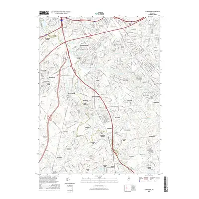
2016 Map of Runnemede
USGS Topo · Published 2016About this map
Runnemede and its surrounding borough-and-township neighbors appear here in the mid-2010s, showing a densely developed suburban corridor along the New Jersey Tpke and Atlantic City Expy. The landscape is defined by the winding course of Big Timber Creek and its many tributaries, including Almonesson Creek and Beaver Brook. These waterways served as the historical anchors for older communities like Clements Bridge and Blenheim, which now integrate into a continuous residential and commercial grid.
Find a feature on this map
87 named features on this map. Tap any name to fly to it.
Don’t see what you’re looking for? This feature index may not catch every label — zoom into the map to look around manually.
Map Details
Editions of this 2016 Runnemede Map
This is the sole edition of this map. No revisions or reprints were ever made.
Other maps of this area

1888 · Mount Holly
USGS Topo · 1:62,500

1890 · Hammonton
USGS Topo · 1:62,500

1890 · Glassboro
USGS Topo · 1:62,500

1891 · Philadelphia
USGS Topo · 1:62,500

1894 · Hammonton
USGS Topo · 1:62,500

1894 · Mount Holly
USGS Topo · 1:62,500

1894 · Philadelphia
USGS Topo · 1:62,500

1896 · Philadelphia
USGS Topo · 1:62,500

1898 · Glassboro
USGS Topo · 1:62,500

1898 · Philadelphia
USGS Topo · 1:62,500
Featured Places
- Cherry Hill Township, NJ
- Washington Township, NJ
- Deptford Township, NJ
- Voorhees Township, NJ
- Lindenwold, NJ