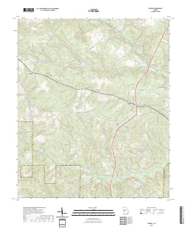
2024 Map of Rupert
USGS Topo · Published 2024About this map
Whitewater Creek and its southern tributaries, including Rambulette Creek and Cedar Creek, define the landscape of this portion of Taylor County. The rural settlements of Charing and Rupert serve as the primary hubs, connected by a network of local roads such as the Americus Hwy and State Rte 127. The area maintains its agricultural and pastoral character, evidenced by numerous family-named routes like Henry Barrow Rd and Woodall Farm Rd.
Find a feature on this map
58 named features on this map. Tap any name to fly to it.
Don’t see what you’re looking for? This feature index may not catch every label — zoom into the map to look around manually.
Map Details
Editions of this 2024 Rupert Map
This is the sole edition of this map. No revisions or reprints were ever made.
Other maps of this area

1955 · Phenix City
USGS Topo · 1:250,000

1957 · Phenix City
USGS Topo · 1:250,000

1958 · Phenix City
USGS Topo · 1:250,000

1971 · Rupert
USGS Topo · 1:24,000

1971 · Ideal South
USGS Topo · 1:24,000

1971 · Ideal North
USGS Topo · 1:24,000

1971 · Ellaville North
USGS Topo · 1:24,000
1971 · Butler West
USGS Topo · 1:24,000

1971 · Tazewell South
USGS Topo · 1:24,000
1971 · Butler East
USGS Topo · 1:24,000